Bristow Island

Bristow Island
(Bobo)
Landsat-Bild von Bristow Island
Gewässer Pazifischer Ozean
Inselgruppe Torres-Strait-Inseln
Geographische Lage 9° 7′ 24″ S, 143° 14′ 27″ O-9.1233333333333143.2408333333320Koordinaten: 9° 7′ 24″ S, 143° 14′ 27″ O
Bristow Island (Papua-Neuguinea)
Länge 8,1 km
Breite 5,1 km
Fläche 33,18 km²
Höchste Erhebung 20 m
Einwohner unbewohnt
Karte der Torres-Strait-Inseln

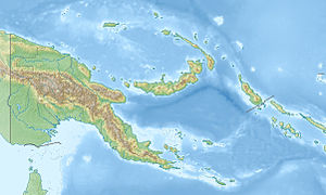
Bristow Island ist eine unbewohnte Insel nahe der Südküste von Papua-Neuguinea in Höhe der Mündung des Fly River. Sie gehört zu den nördlichsten Torres-Strait-Inseln.

Die Insel liegt etwa 1,5 km südlich von Daru Island, auf der sich Daru, die Provinzhauptstadt der Westprovinz, befindet. Die Bewohner von Daru nennen Bristow Island Bobo.

Bristow Island ist flach und dicht mit Mangroven bewachsen.

Siehe auch

  • Liste von Torres-Strait-Inseln
Commons: Bristow Island – Sammlung von Bildern, Videos und Audiodateien
Inselregionen, Hauptinseln und Inselgruppen im Archipel der Torres-Strait-Inseln

zum South Fly District der Westprovinz Papua-Neuguineas gehörige Torres-Strait-Inseln:  Bristow Island | Daru Island | Parama Island  •  Kawai-Inseln | Talbot-Inseln

Top Western:  Boigu | Dauan | Deliverance | Kerr | Saibai | Turnagain | Turu Cay  •  Talbot-Inseln

Western:  Badu | Mabuiag | Moa | Portlock | Tobin  •  Bellevue-Inseln | Duncan-Inseln | Farewell-Inseln | Kulbi-Inseln

Central:  Aureed | Bourke | Coconut | Gabba | Halfway | Sassie | Sue | Yam | Yorke | Zagai  •  Bourke-Inseln | Tetley-Inseln | The Three Sisters | Yorke-Inseln

Eastern:  Bramble | Darnley | Murray | Stephens  •  Murray-Inseln

Inner:  Albany | Booby | Crab | Entrance | Friday | Goods | Hammond | Horn | Packe | Port Lihou | Prince-of-Wales | Thursday | Trochus | Turtle Head | Turtle | Wednesday  •  Manar-Inseln | Red-Wallis-Inseln | Thursday-Inseln | Tuesday-Inseln