Andriba
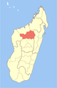
Place in Betsiboka, Madagascar
17°35′S 46°56′E / 17.583°S 46.933°E / -17.583; 46.933 Madagascar
 (2001)[2]
412
Andriba is a municipality in Madagascar. It belongs to the district of Maevatanana, which is a part of Betsiboka Region. The population of the commune was estimated to be approximately 32,000 in 2001 commune census.[2]
Primary and junior level secondary education are available in town. The majority 70% of the population of the commune are farmers, while an additional 25% receives their livelihood from raising livestock. The most important crops are rice and raffia palm, while other important agricultural products are cassava and bambara groundnut. Services provide employment for 5% of the population.[2]
History
On 20 August 1895 French invasion forces approached the town of Andriba that was taken on the following day, after brief combats with the Hova defenders.[3]
References
- ^ Estimated based on DEM data from Shuttle Radar Topography Mission
- ^ a b c "ILO census data". Cornell University. 2002. Retrieved 2008-03-05.
- ^ La prise d'Andriba
- v
- t
- e
Capital: Maevatanana
3 districts; 32 communes
17°35′S 46°56′E / 17.583°S 46.933°E / -17.583; 46.933
 | This Betsiboka location article is a stub. You can help Wikipedia by expanding it. |
- v
- t
- e


