Besbre
River in central France
| Besbre | |
|---|---|
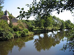 The Besbre at Jaligny-sur-Besbre | |
 | |
| Location | |
| Country | France |
| Physical characteristics | |
| Source | |
| • location | Massif Central |
| Mouth | |
• location | Loire |
• coordinates | 46°33′10″N 3°43′54″E / 46.55278°N 3.73167°E / 46.55278; 3.73167 |
| Length | 106 km (66 mi) |
| Basin size | 762 km2 (294 sq mi) |
| Basin features | |
| Progression | Loire→ Atlantic Ocean |
The Besbre (French pronunciation: [bɛbʁ]) is a river in central France, a left tributary of the Loire. It is 106 km (66 mi) long.[1] Its source is on the mountain of Puy de Montoncel, northeast of Thiers, in the Massif Central. The Besbre flows generally north, through the following departments and towns:
- Allier: Laprugne, Lapalisse, Dompierre-sur-Besbre
- Loire: Saint-Priest-la-Prugne
The Besbre flows into the river Loire 3 kilometres (2 mi) north of Dompierre-sur-Besbre.
References
Wikimedia Commons has media related to Besbre.
Authority control databases | |
|---|---|
| International |
|
| National |
|
- v
- t
- e
 | This Loire geographical article is a stub. You can help Wikipedia by expanding it. |
- v
- t
- e
This article related to a river in France is a stub. You can help Wikipedia by expanding it. |
- v
- t
- e


