Cuitláhuac metro station
Mexico City metro station
19°27′27″N 99°10′55″W / 19.457448°N 99.182038°W / 19.457448; -99.182038 (Cuatro Caminos - Tasqueña)
 10.41%
| Preceding station |  Mexico City Metro Mexico City Metro | Following station | ||
|---|---|---|---|---|
| Tacuba toward Cuatro Caminos | Line 2 | Popotla toward Tasqueña | ||
Route map | |||||||||||||||||||||||||||||||||||||||||||||||||||||||||||||||||||||||||||||||||||||||||||||||||||||||||||||||||||||||||||||||||||||||||||||||||||||||||||||||||||||||||||||||||||||||||||||||||||
|---|---|---|---|---|---|---|---|---|---|---|---|---|---|---|---|---|---|---|---|---|---|---|---|---|---|---|---|---|---|---|---|---|---|---|---|---|---|---|---|---|---|---|---|---|---|---|---|---|---|---|---|---|---|---|---|---|---|---|---|---|---|---|---|---|---|---|---|---|---|---|---|---|---|---|---|---|---|---|---|---|---|---|---|---|---|---|---|---|---|---|---|---|---|---|---|---|---|---|---|---|---|---|---|---|---|---|---|---|---|---|---|---|---|---|---|---|---|---|---|---|---|---|---|---|---|---|---|---|---|---|---|---|---|---|---|---|---|---|---|---|---|---|---|---|---|---|---|---|---|---|---|---|---|---|---|---|---|---|---|---|---|---|---|---|---|---|---|---|---|---|---|---|---|---|---|---|---|---|---|---|---|---|---|---|---|---|---|---|---|---|---|---|---|---|---|
| |||||||||||||||||||||||||||||||||||||||||||||||||||||||||||||||||||||||||||||||||||||||||||||||||||||||||||||||||||||||||||||||||||||||||||||||||||||||||||||||||||||||||||||||||||||||||||||||||||


Location | |
|---|---|
   Cuitláhuac CuitláhuacLocation within Mexico City | |
 | |
| Area map |
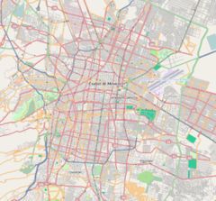
Cuitláhuac is a station on the Mexico City Metro. It is located in the Colonia Popotla and Colonia San Álvaro districts in the Miguel Hidalgo borough of Mexico City, to the northwest of the city center. It lies along Line 2.[2][3] In 2019, the station had an average ridership of 18,615 passengers per day.[4]
Name and pictogram
The station's name comes from nearby Avenida Cuitláhuac, an avenue named in honor of Cultlahuanctzin (whose name was later changed into Spanish language as "Cuitláhuac"). He was the tenth, and penultimate, Aztec emperor and the one who defeated Hernán Cortés in the Battle of La Noche Triste ("Sad Night") in 1520. The station pictogram depicts an Aztec battle shield.[2][3]
General information
The station was opened on 14 September 1970 as part of the second stretch of Line 2, from Pino Suárez to Tacuba.[5]
Metro Cuitláhuac is also close to Avenida México-Tacuba, one of the most important avenues in the city built on the former route of one of Tenochtitláns three main avenues into the mainland. The station also connects with trolleybus Line "I", which runs between Metro El Rosario and Metro Chapultepec.
The station serves the Popotla and San Álvaro neighborhoods.
Ridership
| Annual passenger ridership | |||||
|---|---|---|---|---|---|
| Year | Ridership | Average daily | Rank | % change | Ref. |
| 2023 | 5,244,830 | 14,369 | 88/195 | +10.41% | [1] |
| 2022 | 4,750,532 | 13,015 | 90/195 | +47.85% | [1] |
| 2021 | 3,213,123 | 8,803 | 103/195 | −15.37% | [6] |
| 2020 | 3,796,707 | 10,373 | 96/195 | −44.12% | [7] |
| 2019 | 6,794,715 | 18,615 | 95/195 | −0.36% | [4] |
| 2018 | 6,819,391 | 18,863 | 92/195 | +1.30% | [8] |
| 2017 | 6,732,158 | 18,444 | 92/195 | −3.97% | [9] |
| 2016 | 7,010,603 | 19,154 | 90/195 | −1.31% | [10] |
| 2015 | 7,103,440 | 19,461 | 92/195 | −1.73% | [11] |
| 2014 | 7,228,431 | 19,803 | 91/195 | −5.86% | [12] |
Exits
- South: Calzada México-Tacuba and Avenida Cuitláhuac, Popotla
- North: Calzada México-Tacuba and Avenida Cuitláhuac, Colonia San Álvaro
References
- ^ a b c d "Afluencia de estación por línea 2023" [Station traffic per line 2023] (in Spanish). Sistema Transporte Colectivo Metro. 2024. Archived from the original on 27 January 2024. Retrieved 24 January 2024.
- ^ a b "Cuitláhuac" (in Spanish). Archived from the original on 8 August 2011. Retrieved 16 August 2011.
- ^ a b Archambault, Richard. "Cuitláhuac » Mexico City Metro System". Retrieved 16 August 2011.
- ^ a b "Afluencia de estación por línea 2019" [Station traffic per line 2019] (in Spanish). Sistema Transporte Colectivo Metro. 2020. Archived from the original on 8 April 2020. Retrieved 3 May 2020.
- ^ Monroy, Marco. Schwandl, Robert (ed.). "Opening Dates for Mexico City's Subway". Retrieved 16 August 2011.
- ^ "Afluencia de estación por línea 2021" [Station traffic per line 2021] (in Spanish). Sistema Transporte Colectivo Metro. 2022. Archived from the original on 7 March 2022. Retrieved 7 March 2022.
- ^ "Afluencia de estación por línea 2020" [Station traffic per line 2020] (in Spanish). Sistema Transporte Colectivo Metro. 2021. Archived from the original on 21 June 2021. Retrieved 21 June 2021.
- ^ "Afluencia de estación por línea 2018" [Station traffic per line 2018] (in Spanish). Sistema Transporte Colectivo Metro. 2019. Archived from the original on 6 June 2019. Retrieved 7 April 2020.
- ^ "Afluencia de estación por línea 2017" [Station traffic per line 2017] (in Spanish). Sistema Transporte Colectivo Metro. 2019. Archived from the original on 3 May 2020. Retrieved 3 May 2020.
- ^ "Afluencia de estación por línea 2016" [Station traffic per line 2016] (in Spanish). Sistema Transporte Colectivo Metro. 2017. Archived from the original on 3 May 2020. Retrieved 3 May 2020.
- ^ "Afluencia de estación por línea 2015" [Station traffic per line 2015] (in Spanish). Sistema Transporte Colectivo Metro. 2016. Archived from the original on 3 May 2020. Retrieved 6 May 2020.
- ^ "Afluencia de estación por línea 2014" [Station traffic per line 2014] (in Spanish). Sistema Transporte Colectivo Metro. 2015. Archived from the original on 3 May 2020. Retrieved 6 May 2020.
External links
Wikimedia Commons has media related to Cuitláhuac (station).


| Authority control databases: Geographic |
|
|---|


