Encs District
Districts of Hungary in Borsod-Abaúj-Zemplén
Encs District Encsi járás | |
|---|---|
Districts of Hungary | |
 Coat of arms | |
 Encs District within Hungary and Borsod-Abaúj-Zemplén County. | |
| Country |  Hungary Hungary |
| County | Borsod-Abaúj-Zemplén |
| District seat | Encs |
| Area | |
| • Total | 378.39 km2 (146.10 sq mi) |
| • Rank | 10th in Borsod-Abaúj-Zemplén |
| Population (2011 census) | |
| • Total | 21,390 |
| • Rank | 10th in Borsod-Abaúj-Zemplén |
| • Density | 56/km2 (150/sq mi) |
Encs (Hungarian: Encsi járás) is a district in northern part of Borsod-Abaúj-Zemplén County. Encs is also the name of the town where the district seat is found. The district is located in the Northern Hungary Statistical Region.
Geography
Encs District borders with the Slovakian region of Košice to the north, Gönc District to the east and south, Szikszó District and Edelény District to the south and west. The number of the inhabited places in Encs District is 29.
Municipalities
The district has 1 town and 28 villages. (ordered by population, as of 1 January 2012)[1]
- Alsógagy (96)
- Baktakék (716)
- Beret (274)
- Büttös (174)
- Csenyéte (451)
- Csobád (680)
- Detek (279)
- Encs (6,197) – district seat
- Fáj (364)
- Fancsal (301)
- Felsőgagy (173)
- Forró (2,466)
- Fulókércs (400)
- Gagyapáti (13)
- Garadna (441)
- Hernádpetri (254)
- Hernádszentandrás (465)
- Hernádvécse (1,001)
- Ináncs (1,268)
- Kány (59)
- Keresztéte (70)
- Krasznokvajda (441)
- Litka (49)
- Méra (1,754)
- Novajidrány (1,398)
- Perecse (40)
- Pusztaradvány (257)
- Szalaszend (1,108)
- Szemere (373)
The bolded municipality is the city.
Demographics
Religion in Encs District (2011 census)
Catholic Church (53.8%)
Greek Catholicism (9.4%)
Calvinism (15.8%)
Lutheranism (1.3%)
Other religions (0.8%)
Non-religious (4.1%)
Atheists (0.2%)
Undeclared (14.6%)
In 2011, it had a population of 21,390 and the population density was 56/km2.
| Year | County population[2] | Change |
|---|---|---|
| 2011 | 21,390 | n/a |
Ethnicity
Besides the Hungarian majority, the main minority is the Roma (approx. 5,000).
Total population (2011 census): 21,390
Ethnic groups (2011 census):[3] Identified themselves: 25,108 persons:
- Hungarians: 19,862 (79.11%)
- Gypsies: 4,973 (19.81%)
- Others and indefinable: 273 (1.09%)
Approx. 4,000 persons in Encs District did declare more than one ethnic group at the 2011 census.
Religion
Religious adherence in the county according to 2011 census:[4]
- Catholic – 13,537 (Roman Catholic – 11,519; Greek Catholic – 2,013);
- Reformed – 3,371;
- Evangelical – 277;
- other religions – 172;
- Non-religious – 868;
- Atheism – 41;
- Undeclared – 3,124.
Gallery
-
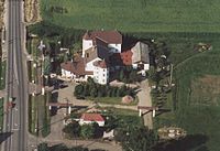
 Encs, the district seat
 -
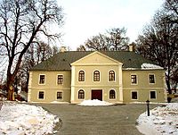 Pallavicini Mansion in Pusztaradvány
 -
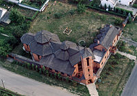
 Aerial view of Forró
 -
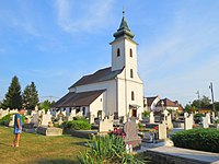 St. Teresa Church in Ináncs


See also
References
External links
- Postal codes of the Encs District

48°23′00″N 21°04′00″E / 48.3833°N 21.0667°E / 48.3833; 21.0667
Authority control databases | |
|---|---|
| International |
|
| National |
|
 | This Borsod-Abaúj-Zemplén location article is a stub. You can help Wikipedia by expanding it. |
- v
- t
- e


