Hegins, Pennsylvania
Census-designated place in Pennsylvania, United States
Hegins, Pennsylvania pronounced Hēgins | |
|---|---|
census-designated place | |
 Friedens United Church of Christ in Hegins. | |
| Country | United States |
| State | Pennsylvania |
| County | Schuylkill |
| Area | |
| • Total | 2.00 sq mi (5.17 km2) |
| • Land | 2.00 sq mi (5.17 km2) |
| • Water | 0.00 sq mi (0.00 km2) |
| Population (2020)[2] | |
| • Total | 798 |
| • Density | 400.00/sq mi (154.41/km2) |
| Time zone | UTC-5 (Eastern (EST)) |
| • Summer (DST) | UTC-4 (EDT) |
| ZIP code | 17938 |
| Area code | 570 |
| FIPS code | 42-33576 |
Hegins (pronounced Higgins) is a census-designated place[3] located in Hegins Township, Schuylkill County in the state of Pennsylvania, United States. The community is located near the community of Valley View at the intersection of Pennsylvania Routes 25 and 125 and is approximately 50 miles northeast of Harrisburg. As of the 2018[4] the population was 850 .
Demographics
| Census | Pop. | Note | %± |
|---|---|---|---|
| 2020 | 798 | — | |
| U.S. Decennial Census[5] | |||
Gallery
-
 Tri-Valley Public Library.
 -
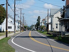 East Main Street in Hegins.
 -
 Hegins Fire Co.


-
 Cafe on Chestnut St.
 -
 Friedens Evangelical Lutheran Church.
 -
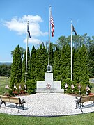 War Memorial on Friedens Cemetery.


References
- ^ "ArcGIS REST Services Directory". United States Census Bureau. Retrieved October 12, 2022.
- ^ "Census Population API". United States Census Bureau. Retrieved October 12, 2022.
- ^ "Archived copy". Archived from the original on September 23, 2015. Retrieved December 7, 2017.
{{cite web}}: CS1 maint: archived copy as title (link) - ^ https://www.census.gov/# [not specific enough to verify]
- ^ "Census of Population and Housing". Census.gov. Retrieved June 4, 2016.
Wikimedia Commons has media related to Hegins, Pennsylvania.
- v
- t
- e
Municipalities and communities of Schuylkill County, Pennsylvania, United States
County seat: Pottsville

- Ashland‡
- Auburn
- Coaldale
- Cressona
- Deer Lake
- Frackville
- Gilberton
- Girardville
- Gordon
- Landingville
- Mahanoy City
- McAdoo
- Mechanicsville
- Middleport
- Minersville
- Mount Carbon
- New Philadelphia
- New Ringgold
- Orwigsburg
- Palo Alto
- Pine Grove
- Port Carbon
- Port Clinton
- Ringtown
- Schuylkill Haven
- Shenandoah
- St. Clair
- Tamaqua
- Tower City
- Tremont
- Barry
- Blythe
- Branch
- Butler
- Cass
- Delano
- East Brunswick
- East Norwegian
- East Union
- Eldred
- Foster
- Frailey
- Hegins
- Hubley
- Kline
- Mahanoy
- New Castle
- North Manheim
- North Union
- Norwegian
- Pine Grove
- Porter
- Reilly
- Rush
- Ryan
- Schuylkill
- South Manheim
- Tremont
- Union
- Upper Mahantongo
- Walker
- Washington
- Wayne
- West Brunswick
- West Mahanoy
- West Penn
- Altamont
- Beurys Lake
- Branchdale
- Brandonville
- Brockton
- Buck Run
- Cumbola
- Delano
- Donaldson
- Duncott
- Englewood
- Forestville
- Fountain Springs
- Friedensburg
- Grier City
- Heckscherville
- Hegins
- Hometown
- Kelayres
- Klingerstown
- Lake Wynonah
- Lavelle
- Llewellyn
- Locustdale‡
- Marlin
- Maryd
- McKeansburg
- Morea
- Muir
- New Boston
- Newtown
- Nuremberg‡
- Oneida
- Orwin
- Park Crest
- Park Place
- Ravine
- Reinerton
- Renningers
- Seltzer
- Shenandoah Heights
- Sheppton
- Summit Station
- Tuscarora
- Valley View
communities
‡This populated place also has portions in an adjacent county or counties
- Pennsylvania portal
- United States portal
40°39′05″N 76°29′51″W / 40.65139°N 76.49750°W / 40.65139; -76.49750
Authority control databases | |
|---|---|
| International |
|
| National |
|


