Imar, Nagorno-Karabakh
Place
Imar / Karamli Իմար / Kərəmli | |
|---|---|
40°09′51.9″N 46°26′54.6″E / 40.164417°N 46.448500°E / 40.164417; 46.448500 | |
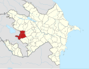
| Country |  Azerbaijan Azerbaijan |
| • District | Kalbajar |
| Elevation | 1,155 m (3,789 ft) |
| Time zone | UTC+4 (AZT) |
Imar (Armenian: Իմար) or Karamli (Azerbaijani: Kərəmli) is a village located in the Kalbajar District of Azerbaijan, in the region of Nagorno-Karabakh. The village had an Azerbaijani-majority population prior to their expulsion during the Nagorno-Karabakh war.[1]
Toponymy
The village was previously known as Imarat Garvand (Azerbaijani: İmarət Qərvənd).[2]
History
During the Soviet period, the village was part of the Mardakert District of the Nagorno-Karabakh Autonomous Oblast.
The human rights organisation Memorial reported about the forced expulsion of the Azerbaijani inhabitants of the village in 1991, along with several other Azerbaijani villages around the area. The village was fully burned to the ground by Armenian forces.[3]
References
- ^ Андрей Зубов. "Андрей Зубов. Карабах: Мир и Война". drugoivzgliad.com (in Russian). Archived from the original on 2020-10-20. Retrieved 2021-02-05.
- ^ "KƏLBƏCƏR RAYONUNUN BƏZİ TOPONİMLƏRİNİN TARİXİ-COĞRAFİ MƏNŞƏYİ HAQQINDA". yerveinsan.az (in Azerbaijani). Yer və İnsan. 22 May 2019. Retrieved 5 February 2021.
- ^ "СОБЫТИЯ, ПРЕДШЕСТВУЮЩИЕ ШТУРМУ ХОДЖАЛЫ". memo.ru (in Russian). Memorial. Archived from the original on 2010-07-31.
External links
- Imar, Nagorno-Karabakh at GEOnet Names Server
- v
- t
- e
Martakert Province
Capital: Martakert
- Martakert

- Aghabekalanj
- Arajadzor
- Chankatagh
- Chapar
- Chldran
- Drmbon
- Garnakar
- Ghazarahogh
- Getavan
- Harutyunagomer
- Haterk
- Imar
- Jraberd
- Khnkavan
- Kichan
- Kmkadzor
- Kochoghot
- Kolatak
- Kusapat
- Maghavuz
- Mehmana
- Mets Shen
- Mokhratagh
- Nareshtar
- Nerkin Horatagh
- Nor Ghazanchi
- Poghosagomer
- Seysulan
- Shahmasur
- Tblghu
- Tonashen
- Tsaghkashen
- Tsmakahogh
- Vaghuhas
- Vank
- Vardadzor
- Varnkatagh
- Verin Horatagh
- Zaglik
- Zardakhach
Portal:
 Geography

 | This Kalbajar Rayon location article is a stub. You can help Wikipedia by expanding it. |
- v
- t
- e
 | This Artsakh location article is a stub. You can help Wikipedia by expanding it. |
- v
- t
- e


