Kinnear, Wyoming
Unincorporated community in Wyoming, United States
43°9′7″N 108°40′39″W / 43.15194°N 108.67750°W / 43.15194; -108.6775082516
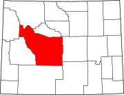
Kinnear is an unincorporated community in central Fremont County, Wyoming, United States. It lies along U.S. Route 26 near its intersection with Wyoming Highway 133, northwest of the city of Riverton and north of the city of Lander, the county seat of Fremont County.[2] Its elevation is 5,400 feet (1,646 m).[1] Kinnear has a post office, with the ZIP code of 82516.[3]
Public education in the community of Kinnear is provided by Fremont County School District #6.
References
- ^ a b "Kinnear, Wyoming". Geographic Names Information System. United States Geological Survey, United States Department of the Interior. Retrieved April 14, 2008.
- ^ Rand McNally. The Road Atlas '08. Chicago: Rand McNally, 2008, p. 116.
- ^ Zip Code Lookup
- v
- t
- e
Municipalities and communities of Fremont County, Wyoming, United States
County seat: Lander
communities
- Wyoming portal
- United States portal
 | This article about a location in Wyoming is a stub. You can help Wikipedia by expanding it. |
- v
- t
- e


