Kolofata
Commune and town in Extrême-Nord, Cameroon
Kolofata | |
|---|---|
Commune and town | |
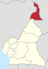
| Country |  Cameroon Cameroon |
| Region | Extrême-Nord |
| Department | Mayo-Sava |
| Time zone | UTC+1 (WAT) |
Kolofata is a town and commune in Cameroon.
Boko Haram Attacks
On January 12, 2015 a military base in Kolofata was assaulted by Boko Haram.[1] The Islamist group had attacked towns in Northern Cameroon in December 2014[2][3] The attack was repelled with only one Cameroonian officer killed.[4][1] 143 Boko Haram insurgents were killed by the Cameroonian Army.[5][6]
Another attack was reported in 2017.
See also
- Communes of Cameroon
Notes
- ^ a b "Boko Haram raids Cameroon army base". Al Jazeera. 12 January 2015. Retrieved 13 January 2015.
- ^ "Cameroon says fights off Boko Haram attacks, kills 41 militants". Reuters. 29 December 2014. Retrieved 29 December 2014.
- ^ "Boko Haram militants stage attacks in northern Cameroon". Reuters. 29 December 2014. Retrieved 30 December 2014.
- ^ "Cameroon says 143 Boko Haram fighters killed in clashes". Reuters. 12 January 2015. Retrieved 13 January 2015.
- ^ "Cameroon repels Boko Haram attack, says 143 militants killed". news.yahoo.com/. AFP. Retrieved 15 January 2015.
- ^ "Le Cameroun fait état d'un lourd revers subi par Boko Haram à Kolofata". rfi.fr. rfi. 13 January 2015. Retrieved 15 January 2015.
References
- Site de la primature - Élections municipales 2002 (in French)
- Contrôle de gestion et performance des services publics communaux des villes camerounaises - Thèse de Donation Avele, Université Montesquieu Bordeaux IV (in French)
- Charles Nanga, La réforme de l’administration territoriale au Cameroun à la lumière de la loi constitutionnelle n° 96/06 du 18 janvier 1996, Mémoire ENA. (in French)
- v
- t
- e
Communes of Far North Region, Cameroon
11°9′44″N 14°0′46″E / 11.16222°N 14.01278°E / 11.16222; 14.01278
 | This Cameroon location article is a stub. You can help Wikipedia by expanding it. |
- v
- t
- e


