Lajo
Commune in Occitania, France
Location of Lajo

(2020–2026) Alain Soulier[1]
1
(2021)[2]
48079 /48120
(avg. 1,220 m or 4,000 ft)
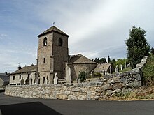
Lajo (French pronunciation: [laʒo]; Occitan: L'Atgièr) is a commune in the Lozère department in southern France.[3]
See also
References
- ^ "Répertoire national des élus: les maires" (in French). data.gouv.fr, Plateforme ouverte des données publiques françaises. 13 September 2022.
- ^ "Populations légales 2021". The National Institute of Statistics and Economic Studies. 28 December 2023.
- ^ INSEE commune file
Wikimedia Commons has media related to Lajo.
- v
- t
- e

- Albaret-le-Comtal
- Albaret-Sainte-Marie
- Allenc
- Altier
- Antrenas
- Arzenc-d'Apcher
- Arzenc-de-Randon
- Auroux
- Badaroux
- Balsièges
- Banassac-Canilhac
- Barjac
- Barre-des-Cévennes
- Bassurels
- La Bastide-Puylaurent
- Bédouès-Cocurès
- Bel-Air-Val-d'Ance
- Les Bessons
- Blavignac
- Les Bondons
- Le Born
- Bourgs sur Colagne
- Brenoux
- Brion
- Le Buisson
- La Canourgue
- Cans et Cévennes
- Cassagnas
- Chadenet
- Chanac
- Chastanier
- Chastel-Nouvel
- Châteauneuf-de-Randon
- Chauchailles
- Chaudeyrac
- Chaulhac
- Cheylard-l'Évêque
- Le Collet-de-Dèze
- Cubières
- Cubiérettes
- Cultures
- Esclanèdes
- La Fage-Montivernoux
- La Fage-Saint-Julien
- Florac Trois Rivièressubpr
- Fontans
- Fournels
- Fraissinet-de-Fourques
- Gabriac
- Gabrias
- Gatuzières
- Gorges du Tarn Causses
- Grandrieu
- Grandvals
- Grèzes
- Les Hermaux
- Hures-la-Parade
- Ispagnac
- Julianges
- Lachamp-Ribennes
- Lajo
- Langogne
- Lanuéjols
- Laubert
- Les Laubies
- Laval-du-Tarn
- Luc
- La Malène
- Le Malzieu-Forain
- Le Malzieu-Ville
- Marchastel
- Marvejols
- Mas-Saint-Chély
- Massegros Causses Gorges
- Mendepref
- Meyrueis
- Moissac-Vallée-Française
- Molezon
- Montbel
- Mont Lozère et Goulet
- Montrodat
- Monts-de-Randon
- Les Monts-Verts
- Nasbinals
- Naussac-Fontanes
- Noalhac
- Palhers
- La Panouse
- Paulhac-en-Margeride
- Pelouse
- Peyre en Aubrac
- Pied-de-Borne
- Pierrefiche
- Le Pompidou
- Pont-de-Montvert-Sud-Mont-Lozère
- Pourcharesses
- Prévenchères
- Prinsuéjols-Malbouzon
- Prunières
- Recoules-d'Aubrac
- Recoules-de-Fumas
- Rimeize
- Rocles
- Rousses
- Le Rozier
- Saint-Alban-sur-Limagnole
- Saint-André-Capcèze
- Saint-André-de-Lancize
- Saint-Bauzile
- Saint-Bonnet-de-Chirac
- Saint-Bonnet-Laval
- Saint-Chély-d'Apcher
- Saint-Denis-en-Margeride
- Sainte-Croix-Vallée-Française
- Sainte-Eulalie
- Sainte-Hélène
- Saint-Étienne-du-Valdonnez
- Saint-Étienne-Vallée-Française
- Saint-Flour-de-Mercoire
- Saint-Frézal-d'Albuges
- Saint-Gal
- Saint-Germain-de-Calberte
- Saint-Germain-du-Teil
- Saint-Hilaire-de-Lavit
- Saint-Jean-la-Fouillouse
- Saint-Juéry
- Saint-Julien-des-Points
- Saint-Laurent-de-Muret
- Saint-Laurent-de-Veyrès
- Saint-Léger-de-Peyre
- Saint-Léger-du-Malzieu
- Saint-Martin-de-Boubaux
- Saint-Martin-de-Lansuscle
- Saint-Michel-de-Dèze
- Saint-Paul-le-Froid
- Saint-Pierre-de-Nogaret
- Saint-Pierre-des-Tripiers
- Saint-Pierre-le-Vieux
- Saint-Privat-de-Vallongue
- Saint-Privat-du-Fau
- Saint-Saturnin
- Saint-Sauveur-de-Ginestoux
- Les Salces
- Les Salelles
- Serverette
- Termes
- La Tieule
- Trélans
- Vebron
- Ventalon-en-Cévennes
- Vialas
- Villefort
- pref: prefecture
- subpr: subprefecture
| Authority control databases: National |
|
|---|
 | This Lozère geographical article is a stub. You can help Wikipedia by expanding it. |
- v
- t
- e


