Larré, Morbihan
Commune in Brittany, France
Commune in Brittany, France
Larré Lare | ||
|---|---|---|
Commune | ||
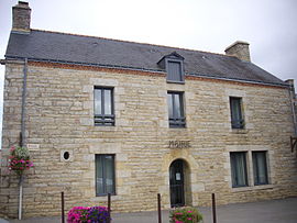 The town hall in Larré | ||
 Coat of arms | ||
Location of Larré  | ||
(2020–2026) Simone Malville[1] | | |
| Area 1 | 17.02 km2 (6.57 sq mi) | |
| Population (2021)[2] | 1,092 | |
| • Density | 64/km2 (170/sq mi) | |
| Time zone | UTC+01:00 (CET) | |
| • Summer (DST) | UTC+02:00 (CEST) | |
| INSEE/Postal code | 56108 /56230 | |
| Elevation | 22–131 m (72–430 ft) | |
| 1 French Land Register data, which excludes lakes, ponds, glaciers > 1 km2 (0.386 sq mi or 247 acres) and river estuaries. | ||
Larré (French pronunciation: [laʁe] ⓘ; Breton: Lare) is a commune in the Morbihan department of Brittany in north-western France.[3]
Geography
The river Arz forms all of the commune's northern border.
Demographics
Inhabitants of Larré are called in French Larréens.
See also
References
- ^ "Maires du Morbihan" (PDF). Préfecture du Morbihan. 7 July 2020.
- ^ "Populations légales 2021". The National Institute of Statistics and Economic Studies. 28 December 2023.
- ^ INSEE commune file
External links
Wikimedia Commons has media related to Larré (Morbihan).
- Base Mérimée: Search for heritage in the commune, Ministère français de la Culture. (in French)
- Mayors of Morbihan Association (in French)
- v
- t
- e
Communes of the Morbihan department 

- Allaire
- Ambon
- Arradon
- Arzal
- Arzon
- Augan
- Auray
- Baden
- Bangor
- Baud
- Béganne
- Beignon
- Belz
- Berné
- Berric
- Bignan
- Billiers
- Billio
- Bohal
- Le Bono
- Brandérion
- Brandivy
- Brech
- Bréhan
- Brignac
- Bubry
- Buléon
- Caden
- Calan
- Camoël
- Camors
- Campénéac
- Carentoir
- Carnac
- Caro
- Caudan
- La Chapelle-Neuve
- Cléguer
- Cléguérec
- Colpo
- Concoret
- Cournon
- Le Cours
- Crac'h
- Crédin
- Le Croisty
- La Croix-Helléan
- Cruguel
- Damgan
- Elven
- Erdeven
- Étel
- Évellys
- Évriguet
- Le Faouët
- Férel
- Forges de Lanouée
- Les Fougerêts
- La Gacilly
- Gâvres
- Gestel
- Gourhel
- Gourin
- Grand-Champ
- La Grée-Saint-Laurent
- Groix
- Guégon
- Guéhenno
- Gueltas
- Guémené-sur-Scorff
- Guénin
- Guer
- Guern
- Le Guerno
- Guidel
- Guillac
- Guilliers
- Guiscriff
- Helléan
- Hennebont
- Le Hézo
- Hœdic
- Houat
- Île-aux-Moines
- Île-d'Arz
- Inguiniel
- Inzinzac-Lochrist
- Josselin
- Kerfourn
- Kergrist
- Kernascléden
- Kervignac
- Landaul
- Landévant
- Lanester
- Langoëlan
- Langonnet
- Languidic
- Lantillac
- Lanvaudan
- Lanvénégen
- Larmor-Baden
- Larmor-Plage
- Larré
- Lauzach
- Lignol
- Limerzel
- Lizio
- Locmalo
- Locmaria
- Locmaria-Grand-Champ
- Locmariaquer
- Locminé
- Locmiquélic
- Locoal-Mendon
- Locqueltas
- Lorientsubpr
- Loyat
- Malansac
- Malestroit
- Malguénac
- Marzan
- Mauron
- Melrand
- Ménéac
- Merlevenez
- Meslan
- Meucon
- Missiriac
- Mohon
- Molac
- Monteneuf
- Monterblanc
- Montertelot
- Moréac
- Moustoir-Ac
- Muzillac
- Néant-sur-Yvel
- Neulliac
- Nivillac
- Nostang
- Noyal-Muzillac
- Noyal-Pontivy
- Le Palais
- Péaule
- Peillac
- Pénestin
- Persquen
- Plaudren
- Plescop
- Pleucadeuc
- Pleugriffet
- Ploemel
- Ploemeur
- Ploërdut
- Ploeren
- Ploërmel
- Plouay
- Plougoumelen
- Plouharnel
- Plouhinec
- Plouray
- Pluherlin
- Plumelec
- Pluméliau-Bieuzy
- Plumelin
- Plumergat
- Pluneret
- Pluvigner
- Pontivysubpr
- Pont-Scorff
- Porcaro
- Port-Louis
- Priziac
- Questembert
- Quéven
- Quiberon
- Quistinic
- Radenac
- Réguiny
- Réminiac
- Riantec
- Rieux
- La Roche-Bernard
- Rochefort-en-Terre
- Rohan
- Roudouallec
- Ruffiac
- Le Saint
- Saint-Abraham
- Saint-Aignan
- Saint-Allouestre
- Saint-Armel
- Saint-Avé
- Saint-Barthélemy
- Saint-Brieuc-de-Mauron
- Saint-Caradec-Trégomel
- Saint-Congard
- Saint-Dolay
- Sainte-Anne-d'Auray
- Sainte-Brigitte
- Sainte-Hélène
- Saint-Gérand-Croixanvec
- Saint-Gildas-de-Rhuys
- Saint-Gonnery
- Saint-Gorgon
- Saint-Gravé
- Saint-Guyomard
- Saint-Jacut-les-Pins
- Saint-Jean-Brévelay
- Saint-Jean-la-Poterie
- Saint-Laurent-sur-Oust
- Saint-Léry
- Saint-Malo-de-Beignon
- Saint-Malo-des-Trois-Fontaines
- Saint-Marcel
- Saint-Martin-sur-Oust
- Saint-Nicolas-du-Tertre
- Saint-Nolff
- Saint-Perreux
- Saint-Philibert
- Saint-Pierre-Quiberon
- Saint-Servant
- Saint-Thuriau
- Saint-Tugdual
- Saint-Vincent-sur-Oust
- Sarzeau
- Sauzon
- Séglien
- Séné
- Sérent
- Silfiac
- Le Sourn
- Sulniac
- Surzur
- Taupont
- Théhillac
- Theix-Noyalo
- Le Tour-du-Parc
- Tréal
- Trédion
- Treffléan
- Tréhorenteuc
- La Trinité-Porhoët
- La Trinité-sur-Mer
- La Trinité-Surzur
- Val d'Oust
- Vannespref
- La Vraie-Croix
- pref: prefecture
- subpr: subprefecture
Authority control databases | |
|---|---|
| National |
|
| Geographic |
|
 | This Morbihan geographical article is a stub. You can help Wikipedia by expanding it. |
- v
- t
- e


