Lucky Man Reserve
Indian reserve in Saskatchewan, Canada
Indian reserve in Canada, Lucky Man
Lucky Man Reserve | |
|---|---|
Indian reserve | |
| Lucky Man Indian Reserve | |
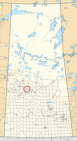 Location in Saskatchewan | |
| First Nation | Lucky Man |
| Country | Canada |
| Province | Saskatchewan |
| Established | 1989 |
| Area | |
| • Total | 3,078.6 ha (7,607.4 acres) |
| Population (2016)[2] | |
| • Total | 0 |
| • Density | 0.0/km2 (0.0/sq mi) |
The Lucky Man Reserve is an Indian reserve of the Lucky Man Cree Nation in Saskatchewan.[1][3] It consists of Sections 25 to 36, Township 46, Range 6, west of the Third Meridian. In the 2016 Canadian Census, it recorded a population of 0 living in 0 of its 0 total private dwellings.[2]
Chief Lucky Man was one of the first adherents to Treaty 6, but his application for a reserve was originally denied. The Lucky Man Cree Nation was re-established in the 1970s, after years of its descendants living on Little Pine 116, and found eligible for a treaty land entitlement claim. In 1989, the band's application for the Mayfair provincial pasture was approved. Few members live on the reserve today.[4]
See also
References
- ^ a b "Reserve/Settlement/Village Detail". Crown–Indigenous Relations and Northern Affairs Canada. Government of Canada. 14 November 2008. Retrieved 12 August 2019.
- ^ a b "Census Profile, 2016 Census". Statistics Canada. 8 February 2017. Retrieved 10 August 2019.
- ^ "Canada Lands Survey System - CLSS Map Browser". Natural Resources Canada. 13 December 2013. Retrieved 9 October 2019.
- ^ Doug, Cuthand (22 July 2016). "Rod King never gave up fighting for his First Nation". Saskatoon StarPhoenix. Retrieved 30 March 2021.
- v
- t
- e
band governments
| Agency Chiefs Tribal Council (Spiritwood) | |
|---|---|
| Battlefords Agency Tribal Chiefs (North Battleford) | |
| Battlefords Tribal Council (North Battleford) | |
| File Hills Qu'Appelle Tribal Council (Fort Qu'Appelle) | |
| Meadow Lake Tribal Council (Meadow Lake) | |
| Prince Albert Grand Council (Prince Albert) | |
| Saskatoon Tribal Council (Saskatoon) | |
| Touchwood Agency Tribal Council (Punnichy) | |
| Yorkton Tribal Administration (Yorkton) | |
| Unaffiliated | |
| Not federally recognized |
| ||
|---|---|---|
| Cities | 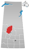 | |
| Towns | ||
| Villages | ||
| Resort villages | ||
| Rural municipalities | ||
| Crown colonies | ||
| First Nations | ||
| Indian reserves |
| |
| Unorganized areas | ||
| Unincorporated communities | ||
53°00′09″N 107°14′17″W / 53.0026°N 107.2381°W / 53.0026; -107.2381 (Lucky Man Reserve)
 | This article about a location in the Census Division No. 16 of Saskatchewan is a stub. You can help Wikipedia by expanding it. |
- v
- t
- e
 | This article about an Indian reserve in Saskatchewan is a stub. You can help Wikipedia by expanding it. |
- v
- t
- e


