Municipal District of Pincher Creek No. 9
Municipal district in Alberta, Canada
Municipal district in Alberta, Canada

Pincher Creek

Cowley

Beaver Mines
Lundbreck
Twin Butte
Twin Butte
Piikani
147
147
Brocket

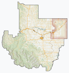
Location within Alberta
(2021)[2]
(2021)[2]
The Municipal District of Pincher Creek No. 9 is a municipal district (MD) in southwestern Alberta, Canada. Located in Census Division No. 3, its municipal office is located in the Town of Pincher Creek.
History
The MD of Pincher Creek No. 9 was originally renamed from the MD of Crowsnest No. 39 to the MD of Pincher Creek No. 39 in 1944. It was renumbered a year later in 1945.
Geography
Communities and localities
| The following urban municipalities are surrounded by the MD of Pincher Creek No. 9.[3]
The following hamlets are located within the MD of Pincher Creek No. 9.[3] | The following localities are located within the MD of Pincher Creek No. 9.[4]
|
Demographics
In the 2021 Census of Population conducted by Statistics Canada, the MD of Pincher Creek No. 9 had a population of 3,240 living in 1,288 of its 1,801 total private dwellings, a change of 9.3% from its 2016 population of 2,965. With a land area of 3,455.75 km2 (1,334.27 sq mi), it had a population density of 0.9/km2 (2.4/sq mi) in 2021.[2]
In the 2016 Census of Population conducted by Statistics Canada, the MD of Pincher Creek No. 9 had a population of 2,965 living in 1,119 of its 1,640 total private dwellings, a -6.1% change from its 2011 population of 3,158. With a land area of 3,482.05 km2 (1,344.43 sq mi), it had a population density of 0.9/km2 (2.2/sq mi) in 2016.[5]
See also
References
- ^ "Municipal Officials Search". Alberta Municipal Affairs. May 9, 2019. Retrieved October 1, 2021.
- ^ a b c "Population and dwelling counts: Canada, provinces and territories, and census subdivisions (municipalities)". Statistics Canada. February 9, 2022. Retrieved February 9, 2022.
- ^ a b "Specialized and Rural Municipalities and Their Communities" (PDF). Alberta Municipal Affairs. January 12, 2022. Retrieved January 21, 2022.
- ^ "Standard Geographical Classification (SGC) 2006, Economic Regions: 4803011 - Pincher Creek No. 9, geographical codes and localities, 2006". Statistics Canada. March 5, 2010. Retrieved August 12, 2012.
- ^ "Population and dwelling counts, for Canada, provinces and territories, and census subdivisions (municipalities), 2016 and 2011 censuses – 100% data (Alberta)". Statistics Canada. February 8, 2017. Retrieved February 8, 2017.
External links
Wikimedia Commons has media related to Pincher Creek No. 9, Alberta.
- Official website

Places adjacent to Municipal District of Pincher Creek No. 9 | ||||||||||||||||
|---|---|---|---|---|---|---|---|---|---|---|---|---|---|---|---|---|
| ||||||||||||||||


- v
- t
- e
Subdivisions of Alberta
service areas
municipalities
municipalities
- Crowsnest Pass, Municipality of
- Jasper, Municipality of
- Lac La Biche County
- Mackenzie County
- Strathcona County
- Wood Buffalo, Regional Municipality of
 Category
 Canada portal
 WikiProject


