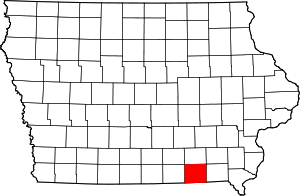
National Register of Historic Places listings in Davis County, Iowa
This is a list of the National Register of Historic Places listings in Davis County, Iowa.
This is intended to be a complete list of the properties and districts on the National Register of Historic Places in Davis County, Iowa, United States. Latitude and longitude coordinates are provided for many National Register properties and districts; these locations may be seen together in a map.[1]
There are 12 properties and districts listed on the National Register in the county, including one National Historic Landmark.
This National Park Service list is complete through NPS recent listings posted June 14, 2024.[2]
Map all coordinates using OpenStreetMap
Download coordinates as:
- KML
- GPX (all coordinates)
- GPX (primary coordinates)
- GPX (secondary coordinates)
| [3] | Name on the Register[4] | Image | Date listed[5] | Location | City or town | Description |
|---|---|---|---|---|---|---|
| 1 | Bloomfield Public Library |  | October 13, 2015 (#15000721) | 107 N. Columbia 40°45′09″N 92°24′59″W / 40.7525°N 92.4164°W / 40.7525; -92.4164 (Bloomfield Public Library) | Bloomfield | |
| 2 | Bloomfield Square |  | November 7, 1976 (#76000756) | Madison, Jefferson, Franklin, and Washington Sts. 40°45′05″N 92°24′52″W / 40.751389°N 92.414444°W / 40.751389; -92.414444 (Bloomfield Square) | Bloomfield | |
| 3 | Davis County Courthouse |  | May 3, 1974 (#74000779) | Bloomfield Town Sq. 40°45′10″N 92°25′01″W / 40.752778°N 92.416944°W / 40.752778; -92.416944 (Davis County Courthouse) | Bloomfield | |
| 4 | William Findley House |  | June 9, 1978 (#78001213) | 302 E. Franklin St. 40°45′01″N 92°24′43″W / 40.750278°N 92.411944°W / 40.750278; -92.411944 (William Findley House) | Bloomfield | |
| 5 | "Lockkeeper's" House | Upload image | October 14, 2009 (#09000826) | Whitefish Trail 40°53′35″N 92°12′26″W / 40.893014°N 92.207117°W / 40.893014; -92.207117 ("Lockkeeper's" House) | Eldon | |
| 6 | Stringtown House | Upload image | April 16, 1974 (#74000780) | East of Centerville on Iowa Highway 2 40°45′34″N 92°24′10″W / 40.759444°N 92.402778°W / 40.759444; -92.402778 (Stringtown House) | Centerville | |
| 7 | Trimble-Parker Historic Farmstead District | Upload image | March 21, 2003 (#03000125) | 23981 240th St. 40°43′01″N 92°22′12″W / 40.716944°N 92.37°W / 40.716944; -92.37 (Trimble-Parker Historic Farmstead District) | Bloomfield | |
| 8 | Troy Academy |  | June 23, 1976 (#76000758) | Off Iowa Highway 2 40°44′47″N 92°12′03″W / 40.746389°N 92.200833°W / 40.746389; -92.200833 (Troy Academy) | Troy | |
| 9 | James B. Weaver House |  | May 15, 1975 (#75000680) | Weaver Park Rd. (U.S. Route 63) 40°45′18″N 92°24′44″W / 40.755°N 92.412222°W / 40.755; -92.412222 (James B. Weaver House) | Bloomfield | |
| 10 | West Grove United Methodist Church |  | May 26, 2004 (#04000514) | 21944 Echo Ave., 40°43′32″N 92°33′23″W / 40.725556°N 92.556389°W / 40.725556; -92.556389 (West Grove United Methodist Church) | West Grove | |
| 11 | Asa Wilson House |  | December 10, 1982 (#82000404) | 207 S. Washington 40°45′00″N 92°24′46″W / 40.75°N 92.412778°W / 40.75; -92.412778 (Asa Wilson House) | Bloomfield | |
| 12 | Henry Wishard House |  | December 15, 2004 (#04001350) | 406 W. Jefferson St. 40°45′05″N 92°25′11″W / 40.751389°N 92.419722°W / 40.751389; -92.419722 (Henry Wishard House) | Bloomfield |
Former listings
| [3] | Name on the Register | Image | Date listed | Date removed | Location | City or town | Description |
|---|---|---|---|---|---|---|---|
| 1 | Clay Avenue Bridge | Upload image | June 25, 1998 (#98000795) | May 8, 2002 | Clay Ave. and 118th St. over intermittent stream 40°44′45″N 92°23′59″W / 40.7459593°N 92.399628°W / 40.7459593; -92.399628 (Clay Avenue Bridge) | Drakesville vicinity | Relocated to McGowen recreation area in 1999. |
| 2 | Russell Octagon House |  | October 8, 1976 (#76000757) | June 11, 1998 | SW of Bloomfield off U.S. 63 | Bloomfield vicinity | |
| 3 | Tarrence Round Barn | Upload image | June 30, 1986 (#86001424) | May 22, 1998 | Off IA 2 | Bloomfield vicinity | Destroyed by a storm in May 1988. |
See also
Wikimedia Commons has media related to National Register of Historic Places in Davis County, Iowa.
- List of National Historic Landmarks in Iowa
- National Register of Historic Places listings in Iowa
- Listings in neighboring counties: Appanoose, Jefferson, Monroe, Schuyler (MO), Scotland (MO), Van Buren, Wapello
References
- ^ The latitude and longitude information provided in this table was derived originally from the National Register Information System, which has been found to be fairly accurate for about 99% of listings. Some locations in this table may have been corrected to current GPS standards.
- ^ National Park Service, United States Department of the Interior, "National Register of Historic Places: Weekly List Actions", retrieved June 14, 2024.
- ^ a b Numbers represent an alphabetical ordering by significant words. Various colorings, defined here, differentiate National Historic Landmarks and historic districts from other NRHP buildings, structures, sites or objects.
- ^ "National Register Information System". National Register of Historic Places. National Park Service. April 24, 2008.
- ^ The eight-digit number below each date is the number assigned to each location in the National Register Information System database, which can be viewed by clicking the number.
- v
- t
- e
- List of U.S. National Historic Landmarks by state:
- Alabama
- Alaska
- Arizona
- Arkansas
- California
- Colorado
- Connecticut
- Delaware
- Florida
- Georgia
- Hawaii
- Idaho
- Illinois
- Indiana
- Iowa
- Kansas
- Kentucky
- Louisiana
- Maine
- Maryland
- Massachusetts
- Michigan
- Minnesota
- Mississippi
- Missouri
- Montana
- Nebraska
- Nevada
- New Hampshire
- New Jersey
- New Mexico
- New York
- North Carolina
- North Dakota
- Ohio
- Oklahoma
- Oregon
- Pennsylvania
- Rhode Island
- South Carolina
- South Dakota
- Tennessee
- Texas
- Utah
- Vermont
- Virginia
- Washington
- West Virginia
- Wisconsin
- Wyoming
 National Register of Historic Places portal
 Category


