Río Tambo District
District in Junín, Peru
Río Tambo | |
|---|---|
District | |
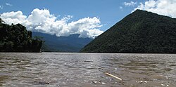 View of the Tambo River near Puerto Prado | |
| Country |  Peru Peru |
| Region | Junín |
| Province | Satipo |
| Founded | January 29, 1943 |
| Capital | Puerto Ocopa |
| Government | |
| • Mayor | Ivan Cisneros Quispe |
| Area | |
| • Total | 10,349.9 km2 (3,996.1 sq mi) |
| Elevation | 275 m (902 ft) |
| Population (2005 census) | |
| • Total | 27,793 |
| • Density | 2.7/km2 (7.0/sq mi) |
| Time zone | UTC-5 (PET) |
| UBIGEO | 120608 |
Río Tambo District is one of eight districts of the province Satipo of Peru.[1]
Climate
| Climate data for Puerto Ocopa, Rio Tambo, elevation 319 m (1,047 ft), (1991–2020) | |||||||||||||
|---|---|---|---|---|---|---|---|---|---|---|---|---|---|
| Month | Jan | Feb | Mar | Apr | May | Jun | Jul | Aug | Sep | Oct | Nov | Dec | Year |
| Mean daily maximum °C (°F) | 31.7 (89.1) | 31.4 (88.5) | 31.9 (89.4) | 32.4 (90.3) | 32.2 (90.0) | 31.9 (89.4) | 32.5 (90.5) | 34.1 (93.4) | 34.7 (94.5) | 34.1 (93.4) | 34.0 (93.2) | 32.0 (89.6) | 32.7 (90.9) |
| Mean daily minimum °C (°F) | 21.8 (71.2) | 21.8 (71.2) | 21.7 (71.1) | 21.4 (70.5) | 20.7 (69.3) | 20.0 (68.0) | 19.0 (66.2) | 19.2 (66.6) | 20.1 (68.2) | 21.1 (70.0) | 21.5 (70.7) | 21.7 (71.1) | 20.8 (69.5) |
| Average precipitation mm (inches) | 147.7 (5.81) | 137.2 (5.40) | 103.6 (4.08) | 47.6 (1.87) | 28.4 (1.12) | 21.0 (0.83) | 22.4 (0.88) | 24.7 (0.97) | 37.8 (1.49) | 58.3 (2.30) | 67.3 (2.65) | 150.9 (5.94) | 846.9 (33.34) |
| Source: National Meteorology and Hydrology Service of Peru[2] | |||||||||||||
See also
- Asháninka Communal Reserve
- Gran Pajonal
- Otishi National Park
References
- ^ (in Spanish) Instituto Nacional de Estadística e Informática. Banco de Información Distrital Archived 2008-04-23 at the Wayback Machine. Retrieved April 11, 2008.
- ^ "Normales Climáticas Estándares y Medias 1991-2020". National Meteorology and Hydrology Service of Peru. Archived from the original on 21 August 2023. Retrieved 17 June 2024.
- v
- t
- e

- Districts of Junín Region
- Peru

- Carhuacallanga
- Chacapampa
- Chicche
- Chilca
- Chongos Alto
- Chupuro
- Colca
- Cullhuas
- El Tambo
- Huacrapuquio
- Hualhuas
- Huancan
- Huancayo
- Huasicancha
- Huayucachi
- Ingenio
- Pariahuanca
- Pilcomayo
- Pucará
- Quichuay
- Quilcas
- San Agustín de Cajas
- San Jerónimo de Tunán
- San Pedro de Saño
- Santo Domingo de Acobamba
- Sapallanga
- Sicaya
- Viques
- Acolla
- Apata
- Ataura
- Canchayllo
- Curicaca
- El Mantaro
- Huamalí
- Huaripampa
- Huertas
- Janjaillo
- Jauja
- Julcán
- Leonor Ordóñez
- Llocllapampa
- Marco
- Masma
- Masma Chicche
- Molinos
- Monobamba
- Muqui
- Muquiyauyo
- Paca
- Paccha
- Pancán
- Parco
- Pomacancha
- Ricran
- San Lorenzo
- San Pedro de Chunan
- Sausa
- Sincos
- Tunan Marca
- Yauli
- Yauyos
11°08′36″S 74°18′49″W / 11.1433°S 74.3135°W / -11.1433; -74.3135
 | This Junín Region geography article is a stub. You can help Wikipedia by expanding it. |
- v
- t
- e


