San Cristóbal, Buenos Aires
Neighborhood of Buenos Aires in C3, Argentina
San Cristóbal | |
|---|---|
 19th architecture in San Cristóbal, once ubiquitous in Buenos Aires | |
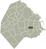 Location of San Cristóbal within Buenos Aires | |
| Country | Argentina |
| Autonomous City | Buenos Aires |
| Comuna | C3 |
| Area | |
| • Total | 2.1 km2 (0.8 sq mi) |
| Population (2001) | |
| • Total | 49,986 |
| • Density | 24,000/km2 (62,000/sq mi) |
| Time zone | UTC-3 (ART) |
San Cristóbal is a barrio or neighbourhood of the Argentine capital, Buenos Aires.
The Subte Line E goes under the San Juan Avenue.
External links
 Argentina portal

- San Cristóbal web (Spanish)
- v
- t
- e
Communes and neighbourhoods of Buenos Aires

- Agronomía
- Almagro
- Balvanera
- Barracas
- Belgrano
- Boedo
- Caballito
- Chacarita
- Coghlan
- Colegiales
- Constitución
- Flores
- Floresta
- La Boca
- La Paternal
- Liniers
- Mataderos
- Monte Castro
- Monserrat
- Nueva Pompeya
- Núñez
- Palermo
- Parque Avellaneda
- Parque Chacabuco
- Parque Chas
- Parque Patricios
- Puerto Madero
- Recoleta
- Retiro
- Saavedra
- San Cristóbal
- San Nicolás
- San Telmo
- Vélez Sársfield
- Versalles
- Villa Crespo
- Villa del Parque
- Villa Devoto
- Villa Lugano
- Villa Luro
- Villa Mitre
- Villa Ortúzar
- Villa Pueyrredón
- Villa Real
- Villa Riachuelo
- Villa Santa Rita
- Villa Soldati
- Villa Urquiza
34°37′25″S 58°23′52″W / 34.6235°S 58.3977°W / -34.6235; -58.3977
Authority control databases | |
|---|---|
| National |
|
| Geographic |
|
 | This article about a location in the City of Buenos Aires, Argentina is a stub. You can help Wikipedia by expanding it. |
- v
- t
- e


