Siagne
River in France


• location
• coordinates
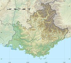
The Siagne (French pronunciation: [sjaɲ]; Occitan: Sianha) is a river that flows through the Var and Alpes-Maritimes departments of southeast France. It is 44.5 km (27.7 mi) long.[1] For much of its length, it forms the border between the two departments. Its drainage basin is 512 km2 (198 sq mi).[2] Its source is near Escragnolles, flowing southeast, through Saint-Cézaire-sur-Siagne and Pégomas, and into the Mediterranean Sea in Mandelieu-la-Napoule, 5 kilometres (3 mi) west of Cannes.
References
Authority control databases | |
|---|---|
| International |
|
| National |
|
| Other |
|
- v
- t
- e
This article related to a river in France is a stub. You can help Wikipedia by expanding it. |
- v
- t
- e


