Tardinghen
You can help expand this article with text translated from the corresponding article in French. (December 2021) Click [show] for important translation instructions.
- Machine translation, like DeepL or Google Translate, is a useful starting point for translations, but translators must revise errors as necessary and confirm that the translation is accurate, rather than simply copy-pasting machine-translated text into the English Wikipedia.
- Consider adding a topic to this template: there are already 6,212 articles in the main category, and specifying
|topic=will aid in categorization. - Do not translate text that appears unreliable or low-quality. If possible, verify the text with references provided in the foreign-language article.
- You must provide copyright attribution in the edit summary accompanying your translation by providing an interlanguage link to the source of your translation. A model attribution edit summary is
Content in this edit is translated from the existing French Wikipedia article at [[:fr:Tardinghen]]; see its history for attribution. - You may also add the template
{{Translated|fr|Tardinghen}}to the talk page. - For more guidance, see Wikipedia:Translation.
Commune in Hauts-de-France, France
Tardinghen Terdingem | ||
|---|---|---|
Commune | ||
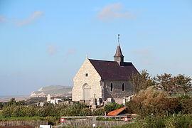 The church of Tardinghen | ||
 Coat of arms | ||
Location of Tardinghen  | ||
(2020–2026) Thibaut Segard[1] | | |
| Area 1 | 8.72 km2 (3.37 sq mi) | |
| Population (2021)[2] | 150 | |
| • Density | 17/km2 (45/sq mi) | |
| Time zone | UTC+01:00 (CET) | |
| • Summer (DST) | UTC+02:00 (CEST) | |
| INSEE/Postal code | 62806 /62179 | |
| Elevation | 1–96 m (3.3–315.0 ft) (avg. 50 m or 160 ft) | |
| 1 French Land Register data, which excludes lakes, ponds, glaciers > 1 km2 (0.386 sq mi or 247 acres) and river estuaries. | ||
Tardinghen (French pronunciation: [taʁdɛ̃ɡɑ̃]; West Flemish: Terdingem, pronounced [tɛrˈdɪŋəm]; Picard: Tardinghin, pronounced [tardɪŋɛ̃]) is a commune in the Pas-de-Calais department in the Hauts-de-France region of France.[3]
Toponymy
Common to many French locales especially in the north, the etymology of Tardinghen is ultimately based in Germanic language roots.
Geography
Tardinghen is situated some 19 kilometres (12 mi) north of Boulogne, at the junction of the D249 and D940 roads, on Cape Gris-Nez. Parts of the coastline, forming the northern border of the commune, have receded inland at about 5 metres (5+1⁄2 yd) per year.
Population
| Year | Pop. | ±% p.a. |
|---|---|---|
| 1968 | 145 | — |
| 1975 | 133 | −1.23% |
| 1982 | 127 | −0.66% |
| 1990 | 117 | −1.02% |
| 1999 | 127 | +0.92% |
| 2007 | 169 | +3.64% |
| 2012 | 147 | −2.75% |
| 2017 | 151 | +0.54% |
| Source: INSEE[4] | ||
Places of interest
- The church of St. Martin, dating from the eighteenth century.
- An eighteenth-century manorhouse.
- Vestiges of the Atlantic Wall.
- Brasserie Artisanale des 2 Caps [nl], local microbrewery.
See also
References
- ^ "Répertoire national des élus: les maires". data.gouv.fr, Plateforme ouverte des données publiques françaises (in French). 2 December 2020.
- ^ "Populations légales 2021". The National Institute of Statistics and Economic Studies. 28 December 2023.
- ^ "Commune de Tardinghen (62806) − COG Insee". www.insee.fr. Retrieved 6 September 2022.
- ^ Population en historique depuis 1968, INSEE
External links
 Media related to Tardinghen at Wikimedia Commons
- The history of Tardinghen on Histopale (in French)
- v
- t
- e
Communes of the Pas-de-Calais department
- Ablain-Saint-Nazaire
- Ablainzevelle
- Acheville
- Achicourt
- Achiet-le-Grand
- Achiet-le-Petit
- Acq
- Acquin-Westbécourt
- Adinfer
- Affringues
- Agnez-lès-Duisans
- Agnières
- Agny
- Aire-sur-la-Lys
- Airon-Notre-Dame
- Airon-Saint-Vaast
- Aix-en-Ergny
- Aix-en-Issart
- Aix-Noulette
- Alembon
- Alette
- Alincthun
- Allouagne
- Alquines
- Ambleteuse
- Ambricourt
- Ambrines
- Ames
- Amettes
- Amplier
- Andres
- Angres
- Annay
- Annequin
- Annezin
- Anvin
- Anzin-Saint-Aubin
- Ardres
- Arleux-en-Gohelle
- Arques
- Arraspref
- Athies
- Les Attaques
- Attin
- Aubigny-en-Artois
- Aubin-Saint-Vaast
- Aubrometz
- Auchel
- Auchy-au-Bois
- Auchy-lès-Hesdin
- Auchy-les-Mines
- Audembert
- Audincthun
- Audinghen
- Audrehem
- Audresselles
- Audruicq
- Aumerval
- Autingues
- Auxi-le-Château
- Averdoingt
- Avesnes
- Avesnes-le-Comte
- Avesnes-lès-Bapaume
- Avion
- Avondance
- Avroult
- Ayette
- Azincourt
- Bailleul-aux-Cornailles
- Bailleul-lès-Pernes
- Bailleulmont
- Bailleul-Sir-Berthoult
- Bailleulval
- Baincthun
- Bainghen
- Bajus
- Balinghem
- Bancourt
- Bapaume
- Baralle
- Barastre
- Barlin
- Barly
- Basseux
- Bavincourt
- Bayenghem-lès-Éperlecques
- Bayenghem-lès-Seninghem
- Bazinghen
- Béalencourt
- Beaudricourt
- Beaufort-Blavincourt
- Beaulencourt
- Beaumerie-Saint-Martin
- Beaumetz-lès-Aire
- Beaumetz-lès-Cambrai
- Beaumetz-lès-Loges
- Beaurains
- Beaurainville
- Beauvoir-Wavans
- Beauvois
- Bécourt
- Béhagnies
- Bellebrune
- Belle-et-Houllefort
- Bellinghem
- Bellonne
- Bénifontaine
- Berck
- Bergueneuse
- Berlencourt-le-Cauroy
- Berles-au-Bois
- Berles-Monchel
- Bermicourt
- Berneville
- Bernieulles
- Bertincourt
- Béthonsart
- Béthunesubpr
- Beugin
- Beugnâtre
- Beugny
- Beussent
- Beutin
- Beuvrequen
- Beuvry
- Bezinghem
- Biache-Saint-Vaast
- Biefvillers-lès-Bapaume
- Bienvillers-au-Bois
- Bihucourt
- Billy-Berclau
- Billy-Montigny
- Bimont
- Blairville
- Blangerval-Blangermont
- Blangy-sur-Ternoise
- Blendecques
- Bléquin
- Blessy
- Blingel
- Boffles
- Boiry-Becquerelle
- Boiry-Notre-Dame
- Boiry-Sainte-Rictrude
- Boiry-Saint-Martin
- Bois-Bernard
- Boisdinghem
- Boisjean
- Boisleux-au-Mont
- Boisleux-Saint-Marc
- Bomy
- Bonnières
- Bonningues-lès-Ardres
- Bonningues-lès-Calais
- Boubers-lès-Hesmond
- Boubers-sur-Canche
- Bouin-Plumoison
- Boulogne-sur-Mersubpr
- Bouquehault
- Bourecq
- Bouret-sur-Canche
- Bourlon
- Bournonville
- Bours
- Boursin
- Bourthes
- Bouvelinghem
- Bouvigny-Boyeffles
- Boyaval
- Boyelles
- Brebières
- Brêmes
- Brévillers
- Bréxent-Énocq
- Brias
- Brimeux
- Bruay-la-Buissière
- Brunembert
- Bucquoy
- Buire-au-Bois
- Buire-le-Sec
- Buissy
- Bullecourt
- Bully-les-Mines
- Buneville
- Burbure
- Bus
- Busnes
- Caffiers
- Cagnicourt
- Calaissubpr
- Calonne-Ricouart
- Calonne-sur-la-Lys
- La Calotterie
- Camblain-Châtelain
- Camblain-l'Abbé
- Cambligneul
- Cambrin
- Camiers
- Campagne-lès-Boulonnais
- Campagne-lès-Guines
- Campagne-lès-Hesdin
- Campagne-lès-Wardrecques
- Campigneulles-les-Grandes
- Campigneulles-les-Petites
- Canettemont
- Canlers
- Capelle-Fermont
- La Capelle-lès-Boulogne
- Capelle-lès-Hesdin
- Carency
- Carly
- Carvin
- La Cauchie
- Cauchy-à-la-Tour
- Caucourt
- Caumont
- Cavron-Saint-Martin
- Chelers
- Chériennes
- Chérisy
- Chocques
- Clairmarais
- Clenleu
- Clerques
- Cléty
- Colembert
- Colline-Beaumont
- La Comté
- Conchil-le-Temple
- Conchy-sur-Canche
- Condette
- Contes
- Conteville-en-Ternois
- Conteville-lès-Boulogne
- Coquelles
- Corbehem
- Cormont
- Couin
- Coullemont
- Coulogne
- Coulomby
- Coupelle-Neuve
- Coupelle-Vieille
- Courcelles-le-Comte
- Courcelles-lès-Lens
- Courrières
- Courset
- La Couture
- Couturelle
- Coyecques
- Crémarest
- Crépy
- Créquy
- Croisette
- Croisilles
- Croix-en-Ternois
- Cucq
- Cuinchy
- Dainville
- Dannes
- Delettes
- Denier
- Dennebrœucq
- Desvres
- Diéval
- Divion
- Dohem
- Douchy-lès-Ayette
- Doudeauville
- Dourges
- Douriez
- Douvrin
- Drocourt
- Drouvin-le-Marais
- Duisans
- Dury
- Echinghen
- Éclimeux
- Écoivres
- Écourt-Saint-Quentin
- Écoust-Saint-Mein
- Ecquedecques
- Ecques
- Écuires
- Écurie
- Éleu-dit-Leauwette
- Elnes
- Embry
- Enquin-lez-Guinegatte
- Enquin-sur-Baillons
- Éperlecques
- Épinoy
- Eps
- Équihen-Plage
- Équirre
- Ergny
- Érin
- Erny-Saint-Julien
- Ervillers
- Escalles
- Escœuilles
- Esquerdes
- Essars
- Estevelles
- Estrée
- Estrée-Blanche
- Estrée-Cauchy
- Estrée-Wamin
- Estréelles
- Étaing
- Étaples
- Éterpigny
- Étrun
- Évin-Malmaison
- Famechon
- Fampoux
- Farbus
- Fauquembergues
- Favreuil
- Febvin-Palfart
- Ferfay
- Ferques
- Festubert
- Feuchy
- Ficheux
- Fiefs
- Fiennes
- Fillièvres
- Fléchin
- Flers
- Fleurbaix
- Fleury
- Floringhem
- Foncquevillers
- Fontaine-lès-Boulans
- Fontaine-lès-Croisilles
- Fontaine-lès-Hermans
- Fontaine-l'Étalon
- Fortel-en-Artois
- Fosseux
- Foufflin-Ricametz
- Fouquereuil
- Fouquières-lès-Béthune
- Fouquières-lès-Lens
- Framecourt
- Frémicourt
- Frencq
- Fresnes-lès-Montauban
- Fresnicourt-le-Dolmen
- Fresnoy
- Fresnoy-en-Gohelle
- Fressin
- Fréthun
- Frévent
- Frévillers
- Frévin-Capelle
- Fruges
- Galametz
- Gauchin-Légal
- Gauchin-Verloingt
- Gaudiempré
- Gavrelle
- Gennes-Ivergny
- Givenchy-en-Gohelle
- Givenchy-le-Noble
- Givenchy-lès-la-Bassée
- Gomiécourt
- Gommecourt
- Gonnehem
- Gosnay
- Gouves
- Gouy-en-Artois
- Gouy-en-Ternois
- Gouy-Saint-André
- Gouy-Servins
- Gouy-sous-Bellonne
- Graincourt-lès-Havrincourt
- Grand-Rullecourt
- Grenay
- Grévillers
- Grigny
- Grincourt-lès-Pas
- Groffliers
- Guarbecque
- Guémappe
- Guemps
- Guigny
- Guinecourt
- Guînes
- Guisy
- Habarcq
- Haillicourt
- Haisnes
- Halinghen
- Hallines
- Halloy
- Ham-en-Artois
- Hamblain-les-Prés
- Hamelincourt
- Hames-Boucres
- Hannescamps
- Haplincourt
- Haravesnes
- Hardinghen
- Harnes
- Haucourt
- Haute-Avesnes
- Hautecloque
- Hauteville
- Haut-Loquin
- Havrincourt
- Hébuterne
- Helfaut
- Hendecourt-lès-Cagnicourt
- Hendecourt-lès-Ransart
- Hénin-Beaumont
- Hénin-sur-Cojeul
- Héninel
- Henneveux
- Hénu
- Herbinghen
- Héricourt
- La Herlière
- Herlincourt
- Herlin-le-Sec
- Herly
- Hermaville
- Hermelinghen
- Hermies
- Hermin
- Hernicourt
- Hersin-Coupigny
- Hervelinghen
- Hesdigneul-lès-Béthune
- Hesdigneul-lès-Boulogne
- Hesdin
- Hesdin-l'Abbé
- Hesmond
- Hestrus
- Heuchin
- Heuringhem
- Hézecques
- Hinges
- Hocquinghen
- Houchin
- Houdain
- Houlle
- Houvin-Houvigneul
- Hubersent
- Huby-Saint-Leu
- Huclier
- Hucqueliers
- Hulluch
- Humbercamps
- Humbert
- Humerœuille
- Humières
- Inchy-en-Artois
- Incourt
- Inxent
- Isbergues
- Isques
- Ivergny
- Izel-lès-Équerchin
- Izel-lès-Hameau
- Journy
- Labeuvrière
- Labourse
- Labroye
- Lacres
- Lagnicourt-Marcel
- Laires
- Lambres
- Landrethun-le-Nord
- Landrethun-lès-Ardres
- Lapugnoy
- Lattre-Saint-Quentin
- Laventie
- Lebiez
- Lebucquière
- Léchelle
- Ledinghem
- Lefaux
- Leforest
- Lenssubpr
- Lépine
- Lespesses
- Lespinoy
- Lestrem
- Leubringhen
- Leulinghem
- Leulinghen-Bernes
- Libercourt
- Licques
- Liencourt
- Lières
- Liettres
- Liévin
- Lignereuil
- Ligny-lès-Aire
- Ligny-Saint-Flochel
- Ligny-sur-Canche
- Ligny-Thilloy
- Lillers
- Linghem
- Linzeux
- Lisbourg
- Locon
- La Loge
- Loison-sous-Lens
- Loison-sur-Créquoise
- Longfossé
- Longuenesse
- Longueville
- Longvilliers
- Loos-en-Gohelle
- Lorgies
- Lottinghen
- Louches
- Lozinghem
- Lugy
- Lumbres
- La Madelaine-sous-Montreuil
- Magnicourt-en-Comte
- Magnicourt-sur-Canche
- Maintenay
- Maisnil
- Maisnil-lès-Ruitz
- Maisoncelle
- Maizières
- Mametz
- Manin
- Maninghem
- Maninghen-Henne
- Marant
- Marck
- Marconne
- Marconnelle
- Marenla
- Maresquel-Ecquemicourt
- Marest
- Maresville
- Marles-les-Mines
- Marles-sur-Canche
- Marœuil
- Marquay
- Marquion
- Marquise
- Martinpuich
- Matringhem
- Mazingarbe
- Mazinghem
- Mencas
- Menneville
- Mentque-Nortbécourt
- Mercatel
- Merck-Saint-Liévin
- Méricourt
- Merlimont
- Metz-en-Couture
- Meurchin
- Mingoval
- Moncheaux-lès-Frévent
- Monchel-sur-Canche
- Monchiet
- Monchy-au-Bois
- Monchy-Breton
- Monchy-Cayeux
- Monchy-le-Preux
- Mondicourt
- Mont-Bernanchon
- Montcavrel
- Montenescourt
- Montigny-en-Gohelle
- Montreuil-sur-Mersubpr
- Mont-Saint-Éloi
- Monts-en-Ternois
- Morchies
- Moringhem
- Morval
- Mory
- Moulle
- Mouriez
- Moyenneville
- Muncq-Nieurlet
- Nabringhen
- Nédon
- Nédonchel
- Nempont-Saint-Firmin
- Nesles
- Neufchâtel-Hardelot
- Neulette
- Neuve-Chapelle
- Neuville-au-Cornet
- Neuville-Bourjonval
- Neuville-Saint-Vaast
- Neuville-sous-Montreuil
- Neuville-Vitasse
- Neuvireuil
- Nielles-lès-Ardres
- Nielles-lès-Bléquin
- Nielles-lès-Calais
- Nœux-lès-Auxi
- Nœux-les-Mines
- Nordausques
- Noreuil
- Norrent-Fontes
- Nortkerque
- Nort-Leulinghem
- Nouvelle-Église
- Noyelles-Godault
- Noyelles-lès-Humières
- Noyelles-lès-Vermelles
- Noyelles-sous-Bellonne
- Noyelles-sous-Lens
- Noyellette
- Noyelle-Vion
- Nuncq-Hautecôte
- Oblinghem
- Œuf-en-Ternois
- Offekerque
- Offin
- Offrethun
- Oignies
- Oisy-le-Verger
- Oppy
- Orville
- Ostreville
- Ourton
- Outreau
- Ouve-Wirquin
- Oye-Plage
- Palluel
- Le Parcq
- Parenty
- Pas-en-Artois
- Pelves
- Penin
- Pernes
- Pernes-lès-Boulogne
- Peuplingues
- Pierremont
- Pihem
- Pihen-lès-Guînes
- Pittefaux
- Planques
- Plouvain
- Polincove
- Pommera
- Pommier
- Le Ponchel
- Pont-à-Vendin
- Le Portel
- Prédefin
- Pressy
- Preures
- Pronville-en-Artois
- Puisieux
- Quéant
- Quelmes
- Quercamps
- Quernes
- Le Quesnoy-en-Artois
- Quesques
- Questrecques
- Quiéry-la-Motte
- Quiestède
- Quilen
- Quœux-Haut-Maînil
- Racquinghem
- Radinghem
- Ramecourt
- Rang-du-Fliers
- Ransart
- Raye-sur-Authie
- Rebergues
- Rebreuve-Ranchicourt
- Rebreuve-sur-Canche
- Rebreuviette
- Reclinghem
- Récourt
- Recques-sur-Course
- Recques-sur-Hem
- Regnauville
- Rely
- Remilly-Wirquin
- Rémy
- Renty
- Rety
- Richebourg
- Riencourt-lès-Bapaume
- Riencourt-lès-Cagnicourt
- Rimboval
- Rinxent
- Rivière
- Robecq
- Roclincourt
- Rocquigny
- Rodelinghem
- Roëllecourt
- Rœux
- Rollancourt
- Rombly
- Roquetoire
- Rougefay
- Roussent
- Rouvroy
- Royon
- Ruisseauville
- Ruitz
- Rumaucourt
- Rumilly
- Ruminghem
- Ruyaulcourt
- Sachin
- Sailly-au-Bois
- Sailly-en-Ostrevent
- Sailly-Labourse
- Sailly-sur-la-Lys
- Sains-en-Gohelle
- Sains-lès-Fressin
- Sains-lès-Marquion
- Sains-lès-Pernes
- Saint-Amand
- Saint-Aubin
- Saint-Augustin
- Saint-Denœux
- Sainte-Austreberthe
- Sainte-Catherine
- Sainte-Marie-Kerque
- Saint-Étienne-au-Mont
- Saint-Floris
- Saint-Folquin
- Saint-Georges
- Saint-Hilaire-Cottes
- Saint-Inglevert
- Saint-Josse
- Saint-Laurent-Blangy
- Saint-Léger
- Saint-Léonard
- Saint-Martin-Boulogne
- Saint-Martin-Choquel
- Saint-Martin-d'Hardinghem
- Saint-Martin-lez-Tatinghem
- Saint-Martin-sur-Cojeul
- Saint-Michel-sous-Bois
- Saint-Michel-sur-Ternoise
- Saint-Nicolas
- Saint-Omersubpr
- Saint-Omer-Capelle
- Saint-Pol-sur-Ternoise
- Saint-Rémy-au-Bois
- Saint-Tricat
- Saint-Venant
- Sallaumines
- Salperwick
- Samer
- Sangatte
- Sanghen
- Sapignies
- Le Sars
- Sars-le-Bois
- Sarton
- Sauchy-Cauchy
- Sauchy-Lestrée
- Saudemont
- Saulchoy
- Saulty
- Savy-Berlette
- Selles
- Sempy
- Seninghem
- Senlecques
- Senlis
- Séricourt
- Serques
- Servins
- Setques
- Sibiville
- Simencourt
- Siracourt
- Sombrin
- Sorrus
- Souastre
- Souchez
- Le Souich
- Surques
- Sus-Saint-Léger
- Tangry
- Tardinghen
- Teneur
- Ternas
- Thélus
- Thérouanne
- Thiembronne
- La Thieuloye
- Thièvres
- Tigny-Noyelle
- Tilloy-lès-Hermaville
- Tilloy-lès-Mofflaines
- Tilly-Capelle
- Tilques
- Tincques
- Tingry
- Tollent
- Torcy
- Tortefontaine
- Tortequesne
- Le Touquet-Paris-Plage
- Tournehem-sur-la-Hem
- Tramecourt
- Le Transloy
- Trescault
- Troisvaux
- Tubersent
- Vacquerie-le-Boucq
- Vacqueriette-Erquières
- Valhuon
- Vaudricourt
- Vaudringhem
- Vaulx
- Vaulx-Vraucourt
- Vélu
- Vendin-lès-Béthune
- Vendin-le-Vieil
- Verchin
- Verchocq
- Verlincthun
- Vermelles
- Verquigneul
- Verquin
- Verton
- Vieil-Hesdin
- Vieille-Chapelle
- Vieille-Église
- Vieil-Moutier
- Villers-au-Bois
- Villers-au-Flos
- Villers-Brûlin
- Villers-Châtel
- Villers-lès-Cagnicourt
- Villers-l'Hôpital
- Villers-Sir-Simon
- Vimy
- Vincly
- Violaines
- Vis-en-Artois
- Vitry-en-Artois
- Waben
- Wacquinghen
- Wail
- Wailly
- Wailly-Beaucamp
- Wambercourt
- Wamin
- Wancourt
- Wanquetin
- Wardrecques
- Warlencourt-Eaucourt
- Warlincourt-lès-Pas
- Warlus
- Warluzel
- Le Wast
- Wavrans-sur-l'Aa
- Wavrans-sur-Ternoise
- Westrehem
- Wicquinghem
- Widehem
- Wierre-au-Bois
- Wierre-Effroy
- Willeman
- Willencourt
- Willerval
- Wimereux
- Wimille
- Wingles
- Wirwignes
- Wismes
- Wisques
- Wissant
- Witternesse
- Wittes
- Wizernes
- Ytres
- Zoteux
- Zouafques
- Zudausques
- Zutkerque
- pref: prefecture
- subpr: subprefecture
| Authority control databases: National |
|
|---|
 | This Pas-de-Calais geographical article is a stub. You can help Wikipedia by expanding it. |
- v
- t
- e


