Terraube
Commune in Occitania, France

Coat of arms
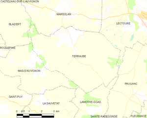
Location of Terraube

(2020–2026) Pierre Laffargue[1]
1
(2021)[2]
32442 /32700
(avg. 160 m or 520 ft)
Terraube (French pronunciation: [tɛʁob]; Gascon: Terrauba) is a commune in the Gers department in southwestern France.
History
During the early stages of the French Wars of Religion in September 1562, many of the largely Protestant inhabitants were massacred by order of the Royalist commander Blaise de Montluc, and their bodies thrown into a well.[3]
Geography
Population
| Year | Pop. | ±% |
|---|---|---|
| 1962 | 520 | — |
| 1968 | 504 | −3.1% |
| 1975 | 522 | +3.6% |
| 1982 | 500 | −4.2% |
| 1990 | 435 | −13.0% |
| 1999 | 381 | −12.4% |
| 2008 | 391 | +2.6% |
See also
References
- ^ "Répertoire national des élus: les maires" (in French). data.gouv.fr, Plateforme ouverte des données publiques françaises. 13 September 2022.
- ^ "Populations légales 2021" (in French). The National Institute of Statistics and Economic Studies. 28 December 2023.
- ^ Knecht 1995, p. 109.
Sources
- Knecht, Robert (1995). "The sword and the pen: Blaise de Monluc and his "Commentaires"". Renaissance Studies. 9 (1). JSTOR 24412373.
Wikimedia Commons has media related to Terraube.
- v
- t
- e
Communes of the Gers department 

- Aignan
- Ansan
- Antras
- Arblade-le-Bas
- Arblade-le-Haut
- Ardizas
- Armentieux
- Armous-et-Cau
- Arrouède
- Aubiet
- Auchpref
- Augnax
- Aujan-Mournède
- Auradé
- Aurensan
- Aurimont
- Aussos
- Auterive
- Aux-Aussat
- Avensac
- Avéron-Bergelle
- Avezan
- Ayguetinte
- Ayzieu
- Bajonnette
- Barcelonne-du-Gers
- Barcugnan
- Barran
- Bars
- Bascous
- Bassoues
- Bazian
- Bazugues
- Beaucaire
- Beaumarchés
- Beaumont
- Beaupuy
- Beccas
- Bédéchan
- Bellegarde
- Belloc-Saint-Clamens
- Belmont
- Béraut
- Berdoues
- Bernède
- Berrac
- Betcave-Aguin
- Bétous
- Betplan
- Bézéril
- Bezolles
- Bézues-Bajon
- Biran
- Bivès
- Blanquefort
- Blaziert
- Blousson-Sérian
- Bonas
- Boucagnères
- Boulaur
- Bourrouillan
- Bouzon-Gellenave
- Bretagne-d'Armagnac
- Le Brouilh-Monbert
- Brugnens
- Cabas-Loumassès
- Cadeilhan
- Cadeillan
- Cahuzac-sur-Adour
- Caillavet
- Callian
- Campagne-d'Armagnac
- Cassaigne
- Castelnau-Barbarens
- Castelnau-d'Anglès
- Castelnau-d'Arbieu
- Castelnau-d'Auzan-Labarrère
- Castelnau-sur-l'Auvignon
- Castelnavet
- Castéra-Lectourois
- Castéra-Verduzan
- Castéron
- Castet-Arrouy
- Castex
- Castex-d'Armagnac
- Castillon-Debats
- Castillon-Massas
- Castillon-Savès
- Castin
- Catonvielle
- Caumont
- Caupenne-d'Armagnac
- Caussens
- Cazaubon
- Cazaux-d'Anglès
- Cazaux-Savès
- Cazaux-Villecomtal
- Cazeneuve
- Céran
- Cézan
- Chélan
- Clermont-Pouyguillès
- Clermont-Savès
- Cologne
- Condomsubpr
- Corneillan
- Couloumé-Mondebat
- Courrensan
- Courties
- Crastes
- Cravencères
- Cuélas
- Dému
- Duffort
- Duran
- Durban
- Eauze
- Encausse
- Endoufielle
- Esclassan-Labastide
- Escornebœuf
- Espaon
- Espas
- Estampes
- Estang
- Estipouy
- Estramiac
- Faget-Abbatial
- Flamarens
- Fleurance
- Fourcès
- Frégouville
- Fustérouau
- Galiax
- Garravet
- Gaudonville
- Gaujac
- Gaujan
- Gavarret-sur-Aulouste
- Gazaupouy
- Gazax-et-Baccarisse
- Gée-Rivière
- Gimbrède
- Gimont
- Giscaro
- Gondrin
- Goutz
- Goux
- Haget
- Haulies
- Homps
- Le Houga
- Idrac-Respaillès
- L'Isle-Arné
- L'Isle-Bouzon
- L'Isle-de-Noé
- L'Isle-Jourdain
- Izotges
- Jegun
- Jû-Belloc
- Juillac
- Juilles
- Justian
- Laas
- Labarthe
- Labarthète
- Labastide-Savès
- Labéjan
- Labrihe
- Ladevèze-Rivière
- Ladevèze-Ville
- Lagarde
- Lagarde-Hachan
- Lagardère
- Lagraulet-du-Gers
- Laguian-Mazous
- Lahas
- Lahitte
- Lalanne
- Lalanne-Arqué
- Lamaguère
- Lamazère
- Lamothe-Goas
- Lannemaignan
- Lannepax
- Lanne-Soubiran
- Lannux
- Larée
- Larressingle
- Larroque-Engalin
- Larroque-Saint-Sernin
- Larroque-sur-l'Osse
- Lartigue
- Lasséran
- Lasserrade
- Lasseube-Propre
- Laujuzan
- Lauraët
- Lavardens
- Laveraët
- Laymont
- Leboulin
- Lectoure
- Lelin-Lapujolle
- Lias
- Lias-d'Armagnac
- Ligardes
- Lombez
- Loubédat
- Loubersan
- Lourties-Monbrun
- Louslitges
- Loussous-Débat
- Lupiac
- Luppé-Violles
- Lussan
- Magnan
- Magnas
- Maignaut-Tauzia
- Malabat
- Manas-Bastanous
- Manciet
- Manent-Montané
- Mansempuy
- Mansencôme
- Marambat
- Maravat
- Marciac
- Marestaing
- Margouët-Meymes
- Marguestau
- Marsan
- Marseillan
- Marsolan
- Mascaras
- Mas-d'Auvignon
- Masseube
- Mauléon-d'Armagnac
- Maulichères
- Maumusson-Laguian
- Maupas
- Maurens
- Mauroux
- Mauvezin
- Meilhan
- Mérens
- Miélan
- Miradoux
- Miramont-d'Astarac
- Miramont-Latour
- Mirandesubpr
- Mirannes
- Mirepoix
- Monbardon
- Monblanc
- Monbrun
- Moncassin
- Monclar
- Monclar-sur-Losse
- Moncorneil-Grazan
- Monferran-Plavès
- Monferran-Savès
- Monfort
- Mongausy
- Monguilhem
- Monlaur-Bernet
- Monlezun
- Monlezun-d'Armagnac
- Monpardiac
- Montadet
- Montamat
- Montaut
- Montaut-les-Créneaux
- Mont-d'Astarac
- Mont-de-Marrast
- Montégut
- Montégut-Arros
- Montégut-Savès
- Montesquiou
- Montestruc-sur-Gers
- Monties
- Montiron
- Montpézat
- Montréal
- Mormès
- Mouchan
- Mouchès
- Mourède
- Nizas
- Nogaro
- Noilhan
- Nougaroulet
- Noulens
- Orbessan
- Ordan-Larroque
- Ornézan
- Pallanne
- Panassac
- Panjas
- Pauilhac
- Pavie
- Pébées
- Pellefigue
- Perchède
- Pergain-Taillac
- Pessan
- Pessoulens
- Peyrecave
- Peyrusse-Grande
- Peyrusse-Massas
- Peyrusse-Vieille
- Pis
- Plaisance
- Plieux
- Polastron
- Pompiac
- Ponsampère
- Ponsan-Soubiran
- Pouydraguin
- Pouylebon
- Pouy-Loubrin
- Pouy-Roquelaure
- Préchac
- Préchac-sur-Adour
- Preignan
- Préneron
- Projan
- Pujaudran
- Puycasquier
- Puylausic
- Puységur
- Ramouzens
- Razengues
- Réans
- Réjaumont
- Ricourt
- Riguepeu
- Riscle
- La Romieu
- Roquebrune
- Roquefort
- Roquelaure
- Roquelaure-Saint-Aubin
- Roquepine
- Roques
- Rozès
- Sabaillan
- Sabazan
- Sadeillan
- Saint-André
- Saint-Antoine
- Saint-Antonin
- Saint-Arailles
- Saint-Arroman
- Saint-Aunix-Lengros
- Saint-Avit-Frandat
- Saint-Blancard
- Saint-Brès
- Saint-Caprais
- Saint-Christaud
- Saint-Clar
- Saint-Créac
- Saint-Cricq
- Sainte-Anne
- Sainte-Aurence-Cazaux
- Sainte-Christie
- Sainte-Christie-d'Armagnac
- Sainte-Dode
- Sainte-Gemme
- Saint-Élix-d'Astarac
- Saint-Élix-Theux
- Sainte-Marie
- Sainte-Mère
- Sainte-Radegonde
- Saint-Georges
- Saint-Germé
- Saint-Germier
- Saint-Griède
- Saint-Jean-le-Comtal
- Saint-Jean-Poutge
- Saint-Justin
- Saint-Lary
- Saint-Léonard
- Saint-Lizier-du-Planté
- Saint-Loube
- Saint-Martin
- Saint-Martin-d'Armagnac
- Saint-Martin-de-Goyne
- Saint-Martin-Gimois
- Saint-Maur
- Saint-Médard
- Saint-Mézard
- Saint-Michel
- Saint-Mont
- Saint-Orens
- Saint-Orens-Pouy-Petit
- Saint-Ost
- Saint-Paul-de-Baïse
- Saint-Pierre-d'Aubézies
- Saint-Puy
- Saint-Sauvy
- Saint-Soulan
- Salles-d'Armagnac
- Samaran
- Samatan
- Sansan
- Saramon
- Sarcos
- Sarragachies
- Sarraguzan
- Sarrant
- La Sauvetat
- Sauveterre
- Sauviac
- Sauvimont
- Savignac-Mona
- Scieurac-et-Flourès
- Séailles
- Ségos
- Ségoufielle
- Seissan
- Sembouès
- Sémézies-Cachan
- Sempesserre
- Sère
- Sérempuy
- Seysses-Savès
- Simorre
- Sion
- Sirac
- Solomiac
- Sorbets
- Tachoires
- Tarsac
- Tasque
- Taybosc
- Termes-d'Armagnac
- Terraube
- Thoux
- Tieste-Uragnoux
- Tillac
- Tirent-Pontéjac
- Touget
- Toujouse
- Tourdun
- Tournan
- Tournecoupe
- Tourrenquets
- Traversères
- Troncens
- Tudelle
- Urdens
- Urgosse
- Valence-sur-Baïse
- Vergoignan
- Verlus
- Vic-Fezensac
- Viella
- Villecomtal-sur-Arros
- Villefranche-d'Astarac
- Viozan
- pref: prefecture
- subpr: subprefecture
Authority control databases | |
|---|---|
| National |
|
| Geographic |
|
 | This Gers geographical article is a stub. You can help Wikipedia by expanding it. |
- v
- t
- e


