The Cliffs Valley, South Carolina
Census-designated place in South Carolina, United States
35°8′13″N 82°26′58″W / 35.13694°N 82.44944°W / 35.13694; -82.44944 (2020)[3]
29690 (Travelers Rest)
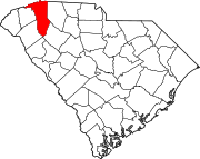
The Cliffs Valley is a resort community and census-designated place (CDP) in Greenville County, South Carolina, United States. It was first listed as a CDP prior to the 2020 census[2] with a population of 736.[4]
The CDP is on the northern edge of Greenville County, extending north to the North Carolina border. U.S. Route 25 forms the western edge of the CDP; the highway leads south 21 miles (34 km) to Greenville and north 16 miles (26 km) to Hendersonville, North Carolina.
The community is in the Blue Ridge Mountains and its foothills. 2,900-foot (880 m) Panther Mountain and 3,025-foot (922 m) Corbin Mountain are on the northern border of the CDP, separated by Panther Gap. 2,800-foot (850 m) Pruett Mountain extends south into the middle of the CDP. The community is drained by Terry Creek, which flows south to the North Saluda River just outside the CDP.
The CDP is home to The Cliffs Valley Golf Course.
Demographics
| Census | Pop. | Note | %± |
|---|---|---|---|
| 2020 | 736 | — | |
| U.S. Decennial Census[5] 2020[6][3] | |||
2020 census
| Race / Ethnicity | Pop 2020[6] | % 2020 |
|---|---|---|
| White alone (NH) | 707 | 96.06% |
| Black or African American alone (NH) | 5 | 0.68% |
| Native American or Alaska Native alone (NH) | 0 | 0.00% |
| Asian alone (NH) | 2 | 0.27% |
| Pacific Islander alone (NH) | 0 | 0.00% |
| Some Other Race alone (NH) | 3 | 0.41% |
| Mixed Race/Multi-Racial (NH) | 12 | 1.63% |
| Hispanic or Latino (any race) | 7 | 0.95% |
| Total | 736 | 100.00% |
Note: the US Census treats Hispanic/Latino as an ethnic category. This table excludes Latinos from the racial categories and assigns them to a separate category. Hispanics/Latinos can be of any race.
References
- ^ "ArcGIS REST Services Directory". United States Census Bureau. Retrieved October 15, 2022.
- ^ a b c U.S. Geological Survey Geographic Names Information System: The Cliffs Valley, South Carolina
- ^ a b "Census Population API". United States Census Bureau. Retrieved October 15, 2022.
- ^ "The Cliffs Valley CDP, South Carolina". United States Census Bureau. Retrieved April 7, 2022.
- ^ "Decennial Census of Population and Housing by Decades". US Census Bureau.
- ^ a b "P2 HISPANIC OR LATINO, AND NOT HISPANIC OR LATINO BY RACE – 2020: DEC Redistricting Data (PL 94-171) – The Cliffs Valley CDP, South Carolina". United States Census Bureau.
- v
- t
- e
Municipalities and communities of Greenville County, South Carolina, United States
County seat: Greenville
communities
‡This populated place also has portions in an adjacent county or counties
- South Carolina portal
- United States portal
 | This South Carolina state location article is a stub. You can help Wikipedia by expanding it. |
- v
- t
- e


