Urukh
River in Kabardino-Balkaria, Russia


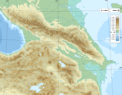
• coordinates
The Urukh (Russian: Урух, Ossetian: Ирӕф / Ӕрӕф, romanized: Irӕf / Ӕrӕf), known as Kharves in its upper reaches,[1] is a river in North Ossetia–Alania and Kabardino-Balkaria (Russia), which flows northeast to join the Terek as a left tributary northwest of Vladikavkaz. The length of the Urukh is 104 km, the area of its drainage basin is 1280 km².[2] The Urukh originates in the glaciers of the Greater Caucasus.[1] The river freezes up in December and remains icebound until March.
References
- ^ a b Урух, Great Soviet Encyclopedia
- ^ "Река Урух (Харвес) in the State Water Register of Russia". textual.ru (in Russian).
- v
- t
- e
 | This Kabardino-Balkaria location article is a stub. You can help Wikipedia by expanding it. |
- v
- t
- e
 | This article related to a river in Russia is a stub. You can help Wikipedia by expanding it. |
- v
- t
- e


