Stavelot
| Stavelot | |
|---|---|
 lippu | |
  Stavelot | |
| Koordinaatit: 50°23′47″N, 5°56′4″E | |
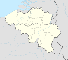
| Valtio | Belgia |
| Alue | Vallonia |
| Maakunta | Liège |
| Arrondissementti | Verviers |
| Hallinto | |
| – Hallinnon tyyppi | Kunta |
| – Pormestari | Thierry de Bournonville |
| Kunnanvaltuusto | 17 paikkaa |
| Pinta-ala | |
| – Kokonaispinta-ala | 85,07 km² |
| Väkiluku (2014) | 6 919 |
| – Väestötiheys | 81,3 as./km² |
| www | |
| Infobox OKVirheellinen NIMI-arvo | |
Stavelot on Liègen provinssissa Valloniassa sijaitseva Belgian kunta. Stavelotin asukasluku on 6 919 (1. tammikuuta 2014) ja sen pinta-ala on 85,07 neliökilometriä.
Aiheesta muualla
 Kuvia tai muita tiedostoja aiheesta Stavelot Wikimedia Commonsissa

Liègen provinssin kunnat
| Amay • Amblève • Ans • Anthisnes • Aubel • Awans • Aywaille • Baelen • Bassenge • Berloz • Beyne-Heusay • Blegny • Braives • Bullange • Burdinne • Burg-Reuland • Butgenbach • Chaudfontaine • Clavier • Comblain-au-Pont • Crisnée • Dalhem • Dison • Donceel • Engis • Esneux • Eupen • Faimes • Ferrières • Fexhe-le-Haut-Clocher • Flémalle • Fléron • Geer • Grâce-Hollogne • Hamoir • Hannut • Héron • Herstal • Herve • Huy • Jalhay • Juprelle • La Calamine • Liège • Lierneux • Limbourg • Lincent • Lontzen • Malmedy • Marchin • Modave • Nandrin • Neupré • Olne • Oreye • Ouffet • Oupeye • Pepinster • Plombières • Raeren • Remicourt • Saint-Georges-sur-Meuse • Saint-Nicolas • Saint-Vith • Seraing • Soumagne • Spa • Sprimont • Stavelot • Stoumont • Theux • Thimister-Clermont • Tinlot • Trois-Ponts • Trooz • Verlaine • Verviers • Villers-le-Bouillet • Visé • Waimes • Wanze • Waremme • Wasseiges • Welkenraedt |


