East Suffolk District
| East Suffolk | |
| East Suffolk District | |
| Distrikt | |
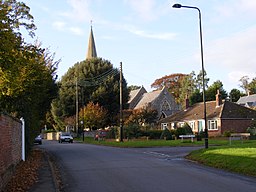 Melton | |
| Land |  Storbritannien Storbritannien |
|---|---|
| Riksdel | England |
| Grevskap | Suffolk |
| Koordinater | 52°06′21″N 1°19′54″Ö / 52.105752°N 1.3316632°Ö / 52.105752; 1.3316632 |
| Area | 1 261,2469 km² |
| Folkmängd | 239 552 (2011) |
| Befolkningstäthet | 190 invånare/km² |
| Grundad | 2019 |
| Datum | 1 april |
| Tidszon | UTC (UTC+0) |
| - sommartid | BST (UTC+1) |
| Geonames | 2650329 |
  Läge i Storbritannien | |
 | |
| Webbplats: https://www.eastsuffolk.gov.uk/ | |
East Suffolk är ett distrikt[1][2] i Suffolk grevskap i England. Distrikt har 239 552 invånare (2011).[3][4] Den bildades den 1 april 2019.[5]
Referenser
- ^ ”East Suffolk”. Ordnance Survey. http://data.ordnancesurvey.co.uk/doc/7000000000175715. Läst 9 juni 2019.
- ^ ”East Suffolk District Council”. Mapit. https://mapit.mysociety.org/area/152160.html. Läst 9 juni 2019.
- ^ ”Suffolk Coastal Local Authority”. Nomis. https://www.nomisweb.co.uk/reports/localarea?compare=E07000205. Läst 3 juni 2019.
- ^ ”Waveney Local Authority”. Nomis. https://www.nomisweb.co.uk/reports/localarea?compare=E07000206. Läst 3 juni 2019.
- ^ ”The East Suffolk (Electoral Changes) Order 2018”. Legislation.gov.uk. http://www.legislation.gov.uk/uksi/2018/1374/introduction/made. Läst 3 juni 2019.
Externa länkar
 Wikimedia Commons har media som rör East Suffolk District.Bilder & media


