Casteil
Commune in Occitania, France
Casteil Castell de Vernet | ||
|---|---|---|
Commune | ||
 Casteil seen from the access road to the Abbey of Saint-Martin du Canigou | ||
 Coat of arms | ||
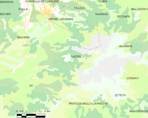
Location of Casteil  | ||
(2020–2026) Olivier Chauveau[1] | | |
| Area 1 | 29.83 km2 (11.52 sq mi) | |
| Population (2021)[2] | 142 | |
| • Density | 4.8/km2 (12/sq mi) | |
| Time zone | UTC+01:00 (CET) | |
| • Summer (DST) | UTC+02:00 (CEST) | |
| INSEE/Postal code | 66043 /66820 | |
| Elevation | 697–2,721 m (2,287–8,927 ft) (avg. 750 m or 2,460 ft) | |
| 1 French Land Register data, which excludes lakes, ponds, glaciers > 1 km2 (0.386 sq mi or 247 acres) and river estuaries. | ||
Casteil (French pronunciation: [castɛj] ⓘ; Catalan: Castell de Vernet) is a commune in the Pyrénées-Orientales department in southern France, part of the historical Conflent comarca. The abbey Martin-du-Canigou is located above Casteil.
Geography
Localisation
Casteil is located in the canton of Le Canigou and in the arrondissement of Prades.
Places adjacent to Casteil | ||||||||||||||||
|---|---|---|---|---|---|---|---|---|---|---|---|---|---|---|---|---|
| ||||||||||||||||


Population
Graphs are unavailable due to technical issues. There is more info on Phabricator and on MediaWiki.org. |
| Year | Pop. | ±% p.a. |
|---|---|---|
| 1968 | 59 | — |
| 1975 | 50 | −2.34% |
| 1982 | 52 | +0.56% |
| 1990 | 102 | +8.79% |
| 1999 | 130 | +2.73% |
| 2007 | 125 | −0.49% |
| 2012 | 129 | +0.63% |
| 2017 | 136 | +1.06% |
| Source: INSEE[3] | ||
See also
References
- ^ "Répertoire national des élus: les maires" (in French). data.gouv.fr, Plateforme ouverte des données publiques françaises. 13 September 2022.
- ^ "Populations légales 2021". The National Institute of Statistics and Economic Studies. 28 December 2023.
- ^ Population en historique depuis 1968, INSEE
Wikimedia Commons has media related to Casteil.
- v
- t
- e

- L'Albère
- Alénya
- Amélie-les-Bains-Palalda
- Les Angles
- Angoustrine-Villeneuve-des-Escaldes
- Ansignan
- Arboussols
- Argelès-sur-Mer
- Arles-sur-Tech
- Ayguatébia-Talau
- Bages
- Baho
- Baillestavy
- Baixas
- Banyuls-dels-Aspres
- Banyuls-sur-Mer
- Le Barcarès
- La Bastide
- Bélesta
- Bolquère
- Bompas
- Boule-d'Amont
- Bouleternère
- Le Boulou
- Bourg-Madame
- Brouilla
- La Cabanasse
- Cabestany
- Caixas
- Calce
- Calmeilles
- Camélas
- Campôme
- Campoussy
- Canaveilles
- Canet-en-Roussillon
- Canohès
- Caramany
- Casefabre
- Cases-de-Pène
- Cassagnes
- Casteil
- Castelnou
- Catllar
- Caudiès-de-Conflent
- Caudiès-de-Fenouillèdes
- Cerbère
- Céretsubpr
- Claira
- Clara-Villerach
- Les Cluses
- Codalet
- Collioure
- Conat
- Corbère
- Corbère-les-Cabanes
- Corneilla-de-Conflent
- Corneilla-del-Vercol
- Corneilla-la-Rivière
- Corsavy
- Coustouges
- Dorres
- Égat
- Elne
- Enveitg
- Err
- Escaro
- Espira-de-Conflent
- Espira-de-l'Agly
- Estagel
- Estavar
- Estoher
- Eus
- Eyne
- Feilluns
- Fenouillet
- Fillols
- Finestret
- Fontpédrouse
- Fontrabiouse
- Font-Romeu-Odeillo-Via
- Formiguères
- Fosse
- Fourques
- Fuilla
- Glorianes
- Ille-sur-Têt
- Joch
- Jujols
- Lamanère
- Lansac
- Laroque-des-Albères
- Latour-Bas-Elne
- Latour-de-Carol
- Latour-de-France
- Lesquerde
- La Llagonne
- Llauro
- Llo
- Llupia
- Mantet
- Marquixanes
- Los Masos
- Matemale
- Maureillas-las-Illas
- Maury
- Millas
- Molitg-les-Bains
- Montalba-le-Château
- Montauriol
- Montbolo
- Montescot
- Montesquieu-des-Albères
- Montferrer
- Mont-Louis
- Montner
- Mosset
- Nahuja
- Néfiach
- Nohèdes
- Nyer
- Olette
- Oms
- Opoul-Périllos
- Oreilla
- Ortaffa
- Osséja
- Palau-de-Cerdagne
- Palau-del-Vidre
- Passa
- Perpignanpref
- Le Perthus
- Peyrestortes
- Pézilla-de-Conflent
- Pézilla-la-Rivière
- Pia
- Planès
- Planèzes
- Pollestres
- Ponteilla
- Porta
- Porté-Puymorens
- Port-Vendres
- Pradessubpr
- Prats-de-Mollo-la-Preste
- Prats-de-Sournia
- Prugnanes
- Prunet-et-Belpuig
- Puyvalador
- Py
- Rabouillet
- Railleu
- Rasiguères
- Réal
- Reynès
- Ria-Sirach
- Rigarda
- Rivesaltes
- Rodès
- Sahorre
- Saillagouse
- Saint-André
- Saint-Arnac
- Saint-Cyprien
- Sainte-Colombe-de-la-Commanderie
- Sainte-Léocadie
- Sainte-Marie-la-Mer
- Saint-Estève
- Saint-Féliu-d'Amont
- Saint-Féliu-d'Avall
- Saint-Génis-des-Fontaines
- Saint-Hippolyte
- Saint-Jean-Lasseille
- Saint-Jean-Pla-de-Corts
- Saint-Laurent-de-Cerdans
- Saint-Laurent-de-la-Salanque
- Saint-Marsal
- Saint-Martin-de-Fenouillet
- Saint-Michel-de-Llotes
- Saint-Nazaire
- Saint-Paul-de-Fenouillet
- Saint-Pierre-dels-Forcats
- Saleilles
- Salses-le-Château
- Sansa
- Sauto
- Serdinya
- Serralongue
- Le Soler
- Sorède
- Souanyas
- Sournia
- Taillet
- Tarerach
- Targasonne
- Taulis
- Taurinya
- Tautavel
- Le Tech
- Terrats
- Théza
- Thuès-Entre-Valls
- Thuir
- Tordères
- Torreilles
- Toulouges
- Tresserre
- Trévillach
- Trilla
- Trouillas
- Ur
- Urbanya
- Valcebollère
- Valmanya
- Vernet-les-Bains
- Villefranche-de-Conflent
- Villelongue-de-la-Salanque
- Villelongue-dels-Monts
- Villemolaque
- Villeneuve-de-la-Raho
- Villeneuve-la-Rivière
- Vinça
- Vingrau
- Vira
- Vivès
- Le Vivier
- pref: prefecture
- subpr: subprefecture
Authority control databases | |
|---|---|
| International |
|
| National |
|
 | This Pyrénées-Orientales geographical article is a stub. You can help Wikipedia by expanding it. |
- v
- t
- e


