Laboule
You can help expand this article with text translated from the corresponding article in French. (December 2008) Click [show] for important translation instructions.
- View a machine-translated version of the French article.
- Machine translation, like DeepL or Google Translate, is a useful starting point for translations, but translators must revise errors as necessary and confirm that the translation is accurate, rather than simply copy-pasting machine-translated text into the English Wikipedia.
- Do not translate text that appears unreliable or low-quality. If possible, verify the text with references provided in the foreign-language article.
- You must provide copyright attribution in the edit summary accompanying your translation by providing an interlanguage link to the source of your translation. A model attribution edit summary is
Content in this edit is translated from the existing French Wikipedia article at [[:fr:Laboule]]; see its history for attribution. - You may also add the template
{{Translated|fr|Laboule}}to the talk page. - For more guidance, see Wikipedia:Translation.
Commune in Auvergne-Rhône-Alpes, France
Laboule | ||
|---|---|---|
Commune | ||
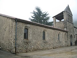 The church in Laboule | ||
Location of Laboule  | ||
(2020–2026) Françoise Gallet[1] | | |
| Area 1 | 17.45 km2 (6.74 sq mi) | |
| Population (2021)[2] | 145 | |
| • Density | 8.3/km2 (22/sq mi) | |
| Time zone | UTC+01:00 (CET) | |
| • Summer (DST) | UTC+02:00 (CEST) | |
| INSEE/Postal code | 07118 /07110 | |
| Elevation | 393–1,410 m (1,289–4,626 ft) (avg. 550 m or 1,800 ft) | |
| 1 French Land Register data, which excludes lakes, ponds, glaciers > 1 km2 (0.386 sq mi or 247 acres) and river estuaries. | ||
Laboule (French pronunciation: [labul]; Occitan: La Bola) is a commune in the Ardèche department in southern France.
Population
|
| ||||||||||||||||||||||||||||||||||||||||||||||||||||||||||||||||||||||||||||||||||||||||||||||||||||||||||||||||||
| Source: EHESS[3] and INSEE (1968-2017)[4] | |||||||||||||||||||||||||||||||||||||||||||||||||||||||||||||||||||||||||||||||||||||||||||||||||||||||||||||||||||
See also
References
- ^ "Répertoire national des élus: les maires". data.gouv.fr, Plateforme ouverte des données publiques françaises (in French). 9 August 2021.
- ^ "Populations légales 2021". The National Institute of Statistics and Economic Studies. 28 December 2023.
- ^ Des villages de Cassini aux communes d'aujourd'hui: Commune data sheet Laboule, EHESS (in French).
- ^ Population en historique depuis 1968, INSEE
Wikimedia Commons has media related to Laboule.
- v
- t
- e

- Accons
- Ailhon
- Aizac
- Ajoux
- Alba-la-Romaine
- Albon-d'Ardèche
- Alboussière
- Alissas
- Andance
- Annonay
- Arcens
- Ardoix
- Arlebosc
- Arras-sur-Rhône
- Les Assions
- Astet
- Aubenas
- Aubignas
- Baix
- Balazuc
- Banne
- Barnas
- Le Béage
- Beauchastel
- Beaulieu
- Beaumont
- Beauvène
- Belsentes
- Berrias-et-Casteljau
- Berzème
- Bessas
- Bidon
- Boffres
- Bogy
- Borée
- Borne
- Boucieu-le-Roi
- Boulieu-lès-Annonay
- Bourg-Saint-Andéol
- Bozas
- Brossainc
- Burzet
- Cellier-du-Luc
- Chalencon
- Le Chambon
- Chambonas
- Champagne
- Champis
- Chandolas
- Chanéac
- Charmes-sur-Rhône
- Charnas
- Chassiers
- Châteaubourg
- Châteauneuf-de-Vernoux
- Chauzon
- Chazeaux
- Cheminas
- Le Cheylard
- Chirols
- Chomérac
- Colombier-le-Cardinal
- Colombier-le-Jeune
- Colombier-le-Vieux
- Cornas
- Coucouron
- Coux
- Le Crestet
- Creysseilles
- Cros-de-Géorand
- Cruas
- Darbres
- Davézieux
- Désaignes
- Devesset
- Dompnac
- Dornas
- Dunière-sur-Eyrieux
- Eclassan
- Empurany
- Étables
- Fabras
- Faugères
- Félines
- Flaviac
- Fons
- Freyssenet
- Genestelle
- Gilhac-et-Bruzac
- Gilhoc-sur-Ormèze
- Gluiras
- Glun
- Gourdon
- Gras
- Gravières
- Grospierres
- Guilherand-Granges
- Issamoulenc
- Issanlas
- Issarlès
- Jaujac
- Jaunac
- Joannas
- Joyeuse
- Juvinas
- Labastide-de-Virac
- Labastide-sur-Bésorgues
- Labatie-d'Andaure
- Labeaume
- Labégude
- Lablachère
- Laboule
- Le Lac-d'Issarlès
- Lachamp-Raphaël
- Lachapelle-Graillouse
- Lachapelle-sous-Aubenas
- Lachapelle-sous-Chanéac
- Lafarre
- Lagorce
- Lalevade-d'Ardèche
- Lalouvesc
- Lamastre
- Lanarce
- Lanas
- Largentièresubpr
- Larnas
- Laurac-en-Vivarais
- Laveyrune
- Lavillatte
- Lavilledieu
- Laviolle
- Lemps
- Lentillères
- Lespéron
- Limony
- Loubaresse
- Lussas
- Lyas
- Malarce-sur-la-Thines
- Malbosc
- Marcols-les-Eaux
- Mariac
- Mars
- Mauves
- Mayres
- Mazan-l'Abbaye
- Mercuer
- Meyras
- Meysse
- Mézilhac
- Mirabel
- Monestier
- Montpezat-sous-Bauzon
- Montréal
- Montselgues
- Nozières
- Les Ollières-sur-Eyrieux
- Orgnac-l'Aven
- Ozon
- Pailharès
- Payzac
- Peaugres
- Péreyres
- Peyraud
- Le Plagnal
- Planzolles
- Plats
- Pont-de-Labeaume
- Pourchères
- Le Pouzin
- Prades
- Pradons
- Pranles
- Préaux
- Privaspref
- Prunet
- Quintenas
- Ribes
- Rochecolombe
- Rochemaure
- Rochepaule
- Rocher
- Rochessauve
- La Rochette
- Rocles
- Roiffieux
- Rompon
- Rosières
- Le Roux
- Ruoms
- Sablières
- Sagnes-et-Goudoulet
- Saint-Agrève
- Saint-Alban-Auriolles
- Saint-Alban-d'Ay
- Saint-Alban-en-Montagne
- Saint-Andéol-de-Berg
- Saint-Andéol-de-Fourchades
- Saint-Andéol-de-Vals
- Saint-André-de-Cruzières
- Saint-André-en-Vivarais
- Saint-André-Lachamp
- Saint-Apollinaire-de-Rias
- Saint-Barthélemy-Grozon
- Saint-Barthélemy-le-Meil
- Saint-Barthélemy-le-Plain
- Saint-Basile
- Saint-Bauzile
- Saint-Christol
- Saint-Cierge-la-Serre
- Saint-Cierge-sous-le-Cheylard
- Saint-Cirgues-de-Prades
- Saint-Cirgues-en-Montagne
- Saint-Clair
- Saint-Clément
- Saint-Cyr
- Saint-Désirat
- Saint-Didier-sous-Aubenas
- Sainte-Eulalie
- Sainte-Marguerite-Lafigère
- Saint-Étienne-de-Boulogne
- Saint-Étienne-de-Fontbellon
- Saint-Étienne-de-Lugdarès
- Saint-Étienne-de-Serre
- Saint-Étienne-de-Valoux
- Saint-Félicien
- Saint-Fortunat-sur-Eyrieux
- Saint-Genest-de-Beauzon
- Saint-Genest-Lachamp
- Saint-Georges-les-Bains
- Saint-Germain
- Saint-Gineys-en-Coiron
- Saint-Jacques-d'Atticieux
- Saint-Jean-Chambre
- Saint-Jean-de-Muzols
- Saint-Jean-le-Centenier
- Saint-Jean-Roure
- Saint-Jeure-d'Andaure
- Saint-Jeure-d'Ay
- Saint-Joseph-des-Bancs
- Saint-Julien-d'Intres
- Saint-Julien-du-Gua
- Saint-Julien-du-Serre
- Saint-Julien-en-Saint-Alban
- Saint-Julien-le-Roux
- Saint-Julien-Vocance
- Saint-Just-d'Ardèche
- Saint-Lager-Bressac
- Saint-Laurent-du-Pape
- Saint-Laurent-les-Bains-Laval-d'Aurelle
- Saint-Laurent-sous-Coiron
- Saint-Marcel-d'Ardèche
- Saint-Marcel-lès-Annonay
- Saint-Martial
- Saint-Martin-d'Ardèche
- Saint-Martin-de-Valamas
- Saint-Martin-sur-Lavezon
- Saint-Maurice-d'Ardèche
- Saint-Maurice-d'Ibie
- Saint-Maurice-en-Chalencon
- Saint-Mélany
- Saint-Michel-d'Aurance
- Saint-Michel-de-Boulogne
- Saint-Michel-de-Chabrillanoux
- Saint-Montan
- Saint-Paul-le-Jeune
- Saint-Péray
- Saint-Pierre-de-Colombier
- Saint-Pierre-la-Roche
- Saint-Pierre-Saint-Jean
- Saint-Pierre-sur-Doux
- Saint-Pierreville
- Saint-Pons
- Saint-Priest
- Saint-Privat
- Saint-Prix
- Saint-Remèze
- Saint-Romain-d'Ay
- Saint-Romain-de-Lerps
- Saint-Sauveur-de-Cruzières
- Saint-Sauveur-de-Montagut
- Saint-Sernin
- Saint-Sylvestre
- Saint-Symphorien-de-Mahun
- Saint-Symphorien-sous-Chomérac
- Saint-Thomé
- Saint-Victor
- Saint-Vincent-de-Barrès
- Saint-Vincent-de-Durfort
- Salavas
- Les Salelles
- Sampzon
- Sanilhac
- Sarras
- Satillieu
- Savas
- Sceautres
- Sécheras
- Serrières
- Silhac
- La Souche
- Soyons
- Talencieux
- Tauriers
- Le Teil
- Thorrenc
- Thueyts
- Toulaud
- Tournon-sur-Rhônesubpr
- Ucel
- Usclades-et-Rieutord
- Uzer
- Vagnas
- Valgorge
- Vallées-d'Antraigues-Asperjoc
- Vallon-Pont-d'Arc
- Vals-les-Bains
- Valvignères
- Vanosc
- Les Vans
- Vaudevant
- Vernon
- Vernosc-lès-Annonay
- Vernoux-en-Vivarais
- Vesseaux
- Veyras
- Villeneuve-de-Berg
- Villevocance
- Vinezac
- Vinzieux
- Vion
- Viviers
- Vocance
- Vogüé
- La Voulte-sur-Rhône
- pref: prefecture
- subpr: subprefecture
| Authority control databases |
|
|---|
 | This Ardèche geographical article is a stub. You can help Wikipedia by expanding it. |
- v
- t
- e


